Refine search
Actions for selected content:
95781 results in Archaeology
Manifest Destiny in Southeast Asia: Archaeology of American Colonial Industry in the Philippines, 1898–1987
-
- Journal:
- American Antiquity / Volume 89 / Issue 3 / July 2024
- Published online by Cambridge University Press:
- 06 May 2024, pp. 417-439
- Print publication:
- July 2024
-
- Article
-
- You have access
- Open access
- HTML
- Export citation
Archaeological object interviews as a method to study and engage with finder-collectors
-
- Article
-
- You have access
- Open access
- HTML
- Export citation
Aeolian dynamics at the northern edge of Deliblato (Banat) Sand Sea, Vojvodina, Serbia, at the time of the last deglaciation
-
- Journal:
- Quaternary Research / Volume 121 / September 2024
- Published online by Cambridge University Press:
- 03 May 2024, pp. 59-72
-
- Article
- Export citation
Maritime Prehistory of Northeast Asia. Jim Cassidy, Irina Ponkratova, and Ben Fitzhugh, editors. 2022. Springer, Singapore. $109.99 (hardcover), ISBN 978-981-19-1117-0. $109.99 (paperback), ISBN 978-981-19-1120-0. $84.99 (e-book), ISBN 978-981-19-1118-7.
-
- Journal:
- American Antiquity / Volume 89 / Issue 3 / July 2024
- Published online by Cambridge University Press:
- 03 May 2024, pp. 541-542
- Print publication:
- July 2024
-
- Article
- Export citation
EMERGING EMPIRES AND OPPORTUNISTIC LAND-USE LEGACIES: TESTING A NEW MODEL ON ROME'S CONQUEST AND COLONIZATION THROUGH ARCHAEOLOGICAL SURVEY DATA IN THE TERRITORIES OF COSA AND TARRACO
-
- Journal:
- Papers of the British School at Rome / Volume 92 / October 2024
- Published online by Cambridge University Press:
- 03 May 2024, pp. 1-21
- Print publication:
- October 2024
-
- Article
-
- You have access
- Open access
- HTML
- Export citation
How far does culture go?
-
- Journal:
- Archaeological Dialogues / Volume 30 / Issue 2 / December 2023
- Published online by Cambridge University Press:
- 03 May 2024, pp. 163-167
-
- Article
-
- You have access
- Open access
- HTML
- Export citation
A Paperless and 3D Workflow for Documenting Excavations at Insula I.14, Pompeii, Italy
-
- Journal:
- Advances in Archaeological Practice / Volume 12 / Issue 2 / May 2024
- Published online by Cambridge University Press:
- 03 May 2024, pp. 107-121
-
- Article
-
- You have access
- Open access
- HTML
- Export citation
Levanna: Interpretation and Controversy in New York Archaeology, 1923–2018. Jack Rossen. Rowman & Littlefield, Lanham, Maryland. xvii + 197 pp. $80.00 (hardcover), ISBN 978-1-5381-2829-9. $36.00 (paperback), ISBN 978-1-5381-5840-1. $34.00 (e-book), ISBN 978-1-5381-2830-5.
-
- Journal:
- American Antiquity / Volume 89 / Issue 3 / July 2024
- Published online by Cambridge University Press:
- 03 May 2024, pp. 535-536
- Print publication:
- July 2024
-
- Article
- Export citation
La societas Sisaponensis, los lingotes de Doña Rama-Belmez y la explotación minera de los montes de Corduba
-
- Journal:
- Journal of Roman Archaeology / Volume 37 / Issue 1 / June 2024
- Published online by Cambridge University Press:
- 03 May 2024, pp. 148-187
- Print publication:
- June 2024
-
- Article
-
- You have access
- Open access
- HTML
- Export citation
Here and Now at Historic Sites
- Pupils and Guides Experiencing Heritage
-
- Published online:
- 02 May 2024
- Print publication:
- 23 May 2024
-
- Element
-
- You have access
- Open access
- HTML
- Export citation
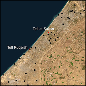
New investigations in Gaza's heritage landscapes: the Gaza Maritime Archaeology Project (GAZAMAP)
-
- Article
-
- You have access
- Open access
- HTML
- Export citation
The Palaeolithic of Northeast Asia: The History and Results of Research 1940–1980. Vitaly A. Kashin. Translated and edited by Richard L. Bland and Yaroslav V. Kuzmin. 2023. Archaeopress, Oxford. x + 124 pp. £30.00 (paperback), ISBN 978-1-80327-390-7.
-
- Journal:
- American Antiquity / Volume 89 / Issue 3 / July 2024
- Published online by Cambridge University Press:
- 02 May 2024, pp. 542-544
- Print publication:
- July 2024
-
- Article
- Export citation
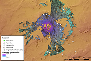
Seashells and sound waves: modelling soundscapes in Chacoan great-house communities
-
- Article
-
- You have access
- Open access
- HTML
- Export citation
Roman-period trade in ceramic building materials on the Levantine Mediterranean coast: evidence from a farmstead site near Ashqelon/Ascalon, Israel
-
- Journal:
- Journal of Roman Archaeology / Volume 37 / Issue 1 / June 2024
- Published online by Cambridge University Press:
- 02 May 2024, pp. 188-214
- Print publication:
- June 2024
-
- Article
- Export citation
Repairing Historic Injustice: The Return of Indigenous Peoples’ Ancestral Human Remains Through Transitional Justice
-
- Journal:
- International Journal of Cultural Property / Volume 30 / Issue 4 / November 2023
- Published online by Cambridge University Press:
- 02 May 2024, pp. 419-438
-
- Article
-
- You have access
- HTML
- Export citation
Exploring rural life in Roman Anatolia - P. Thonemann 2022. The Lives of Ancient Villages: Rural Society in Roman Anatolia. Greek culture in the Roman world. Pp. 396. Cambridge and New York: Cambridge University Press. ISBN 9781009123211.
-
- Journal:
- Journal of Roman Archaeology / Volume 37 / Issue 1 / June 2024
- Published online by Cambridge University Press:
- 30 April 2024, pp. 365-371
- Print publication:
- June 2024
-
- Article
- Export citation
RADIOCARBON VARIATIONS IN ANNUAL TREE RINGS WITH 11-YEAR SOLAR CYCLES DURING 1800–1950
-
- Journal:
- Radiocarbon / Volume 66 / Issue 5 / October 2024
- Published online by Cambridge University Press:
- 30 April 2024, pp. 973-988
- Print publication:
- October 2024
-
- Article
- Export citation
An archaeology of the Pomeranian Crime of 1939: collecting the material evidence
- Part of
-
- Article
-
- You have access
- Open access
- HTML
- Export citation
14C GIRI SAMPLES IN AMS GOLDEN VALLEY: GRAPHITE PREPARATION USING AGE-3 AND ABSORPTION-CATALYTIC SETUP
-
- Journal:
- Radiocarbon / Volume 66 / Issue 5 / October 2024
- Published online by Cambridge University Press:
- 29 April 2024, pp. 1259-1269
- Print publication:
- October 2024
-
- Article
- Export citation
The Muse of Zenon: from Syracuse to the Museum of Guadalajara
-
- Journal:
- Journal of Roman Archaeology / Volume 37 / Issue 1 / June 2024
- Published online by Cambridge University Press:
- 29 April 2024, pp. 304-336
- Print publication:
- June 2024
-
- Article
-
- You have access
- Open access
- HTML
- Export citation
