Refine search
Actions for selected content:
95781 results in Archaeology
Aerial, Surface, and Subsurface Multimodal Mapping in Coastal Peru: Insights from Cerro San Isidro, Moro Region, Nepeña Valley
-
- Journal:
- Advances in Archaeological Practice / Volume 12 / Issue 2 / May 2024
- Published online by Cambridge University Press:
- 05 April 2024, pp. 143-155
-
- Article
-
- You have access
- Open access
- HTML
- Export citation
Reconsidering Mississippian Communities and Households. Elizabeth Watts Malouchos and Alleen Betzenhauser, editors. 2021. University of Alabama Press, Tuscaloosa. $64.95 (hardcover), ISBN 978-0-8173-2088-1. $64.95 (e-book), ISBN 978-0-8173-9346-5.
-
- Journal:
- American Antiquity / Volume 89 / Issue 3 / July 2024
- Published online by Cambridge University Press:
- 05 April 2024, pp. 530-531
- Print publication:
- July 2024
-
- Article
- Export citation
Northern Archaeology and Cosmology: A Relational View. Vesa-Pekka Herva and Antti Lahelma. 2020. Routledge, London. ix + 202 pp. $160.00 (hardcover), ISBN 978-1-138-35898-0; $46.95 (paper), ISBN 978-1-138-35901-7; $0.00 (e-book), ISBN 978-0-429-43394-8.
-
- Journal:
- American Antiquity / Volume 89 / Issue 3 / July 2024
- Published online by Cambridge University Press:
- 05 April 2024, pp. 536-537
- Print publication:
- July 2024
-
- Article
- Export citation
After Dark: The Nocturnal Urban Landscape and Lightscape of Ancient Cities. Nancy Gonlin and Meghan E. Strong, editors. 2022. University Press of Colorado, Louisville. xvi + 296 pp. $76.00 (hardcover), ISBN 978-1-64642-259-3. $61.00 (e-book), ISBN 978-1-64642-260-9.
-
- Journal:
- American Antiquity / Volume 89 / Issue 3 / July 2024
- Published online by Cambridge University Press:
- 05 April 2024, pp. 528-530
- Print publication:
- July 2024
-
- Article
- Export citation
The Pleistocene Social Contract: Culture and Cooperation in Human Evolution. Kim Sterelny. 2021. Oxford University Press, New York. xi + 182 pp. $74.00 (hardcover), ISBN 978-0-19-753138-9.
-
- Journal:
- American Antiquity / Volume 89 / Issue 3 / July 2024
- Published online by Cambridge University Press:
- 05 April 2024, pp. 539-541
- Print publication:
- July 2024
-
- Article
- Export citation
IMPROVING IONPLUS MICADAS PERFORMANCE WITH RECESSED GRAPHITE
-
- Journal:
- Radiocarbon / Volume 66 / Issue 5 / October 2024
- Published online by Cambridge University Press:
- 04 April 2024, pp. 1460-1468
- Print publication:
- October 2024
-
- Article
- Export citation
Chronology of the early transgressive phase of Lake Bonneville
-
- Journal:
- Quaternary Research / Volume 121 / September 2024
- Published online by Cambridge University Press:
- 04 April 2024, pp. 32-39
-
- Article
- Export citation
SQUEAKY CLEAN CELLULOSE: COMPARING PRETREATMENT EFFECTIVENESS ON SINGLE TREE RINGS AND WOODEN LATHS
-
- Journal:
- Radiocarbon / Volume 66 / Issue 5 / October 2024
- Published online by Cambridge University Press:
- 04 April 2024, pp. 1200-1212
- Print publication:
- October 2024
-
- Article
-
- You have access
- Open access
- HTML
- Export citation
RADIOCARBON AGES OF PLANT REMAINS IN MASSIVE GROUND ICE AND UNDERLYING SEDIMENTS OF THE BARROW PERMAFROST TUNNEL, ALASKA
-
- Journal:
- Radiocarbon / Volume 66 / Issue 5 / October 2024
- Published online by Cambridge University Press:
- 04 April 2024, pp. 879-891
- Print publication:
- October 2024
-
- Article
-
- You have access
- Open access
- HTML
- Export citation
The Methods and Ethics of Researching Unprovenienced Artifacts from East Asia
-
- Published online:
- 03 April 2024
- Print publication:
- 25 April 2024
-
- Element
-
- You have access
- Open access
- HTML
- Export citation
Dances with Zigzags in Toro Muerto, Peru: Geometric Petroglyphs as (Possible) Embodiments of Songs
-
- Journal:
- Cambridge Archaeological Journal / Volume 34 / Issue 4 / November 2024
- Published online by Cambridge University Press:
- 03 April 2024, pp. 671-691
-
- Article
-
- You have access
- Open access
- HTML
- Export citation
Ancient Southeast Mesoamerica
- Political Economies without the State
-
- Published online:
- 02 April 2024
- Print publication:
- 21 March 2024
First Cities
- Planning Lessons for the 21st Century
-
- Published online:
- 02 April 2024
- Print publication:
- 04 April 2024
-
- Element
- Export citation
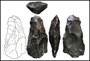
Lithics in the Maya Region: Exploring Gendered Trends in Research in the Last Decade
-
- Journal:
- Latin American Antiquity / Volume 35 / Issue 2 / June 2024
- Published online by Cambridge University Press:
- 02 April 2024, pp. 348-363
- Print publication:
- June 2024
-
- Article
-
- You have access
- Open access
- HTML
- Export citation
Starch Granule Yields from Open-Air Metates Unaffected by Environmental Contamination
-
- Journal:
- American Antiquity / Volume 90 / Issue 1 / January 2025
- Published online by Cambridge University Press:
- 02 April 2024, pp. 191-199
- Print publication:
- January 2025
-
- Article
-
- You have access
- Open access
- HTML
- Export citation
Arte rupestre del primer y segundo milenio dC en las sierras de Velasco y de La Punta (La Rioja, Argentina)
-
- Journal:
- Latin American Antiquity / Volume 36 / Issue 2 / June 2025
- Published online by Cambridge University Press:
- 02 April 2024, pp. 316-338
- Print publication:
- June 2025
-
- Article
- Export citation
Life in a Mississippian Warscape: Common Field, Cahokia, and the Effects of Warfare. Meghan E. Buchanan. 2022. University of Alabama Press, Tuscaloosa. x + 182 pp. $54.95 (hardcover), ISBN 978-0-8173-2138-3. $54.95 (e-book), ISBN 978-0-8173-9420-2.
-
- Journal:
- American Antiquity / Volume 89 / Issue 3 / July 2024
- Published online by Cambridge University Press:
- 02 April 2024, pp. 532-533
- Print publication:
- July 2024
-
- Article
- Export citation
The Mandate for Speculation: Responding to Uncertainty in Archaeological Thinking
-
- Journal:
- Cambridge Archaeological Journal / Volume 34 / Issue 4 / November 2024
- Published online by Cambridge University Press:
- 01 April 2024, pp. 621-636
-
- Article
-
- You have access
- Open access
- HTML
- Export citation
A Social Network Analysis of Traditional Labrets and Horizontal Relationships in the Salish Sea Region of Northwestern North America
-
- Journal:
- American Antiquity / Volume 89 / Issue 2 / April 2024
- Published online by Cambridge University Press:
- 07 May 2024, pp. 202-220
- Print publication:
- April 2024
-
- Article
-
- You have access
- Open access
- HTML
- Export citation
