Refine search
Actions for selected content:
95781 results in Archaeology
ATM volume 34 issue 3 Cover and Back matter
-
- Journal:
- Ancient Mesoamerica / Volume 34 / Issue 3 / Fall 2023
- Published online by Cambridge University Press:
- 28 March 2024, pp. b1-b2
-
- Article
-
- You have access
- Export citation
Gini coefficient at La Corona: The impacts of variation in analytical unit and aggregation scale
-
- Journal:
- Ancient Mesoamerica / Volume 34 / Issue 3 / Fall 2023
- Published online by Cambridge University Press:
- 28 March 2024, e7
-
- Article
-
- You have access
- Open access
- HTML
- Export citation
Exploring inequality at Copan, Honduras: A 2D and 3D geospatial comparison of household wealth
-
- Journal:
- Ancient Mesoamerica / Volume 34 / Issue 3 / Fall 2023
- Published online by Cambridge University Press:
- 28 March 2024, e11
-
- Article
-
- You have access
- Open access
- HTML
- Export citation
Inequality on the southwest Maya frontier: House size variations in three polities of the Rosario Valley, Chiapas
-
- Journal:
- Ancient Mesoamerica / Volume 34 / Issue 3 / Fall 2023
- Published online by Cambridge University Press:
- 28 March 2024, e4
-
- Article
-
- You have access
- Open access
- HTML
- Export citation
Measuring inequality: The effect of units of analysis on the Gini coefficient
-
- Journal:
- Ancient Mesoamerica / Volume 34 / Issue 3 / Fall 2023
- Published online by Cambridge University Press:
- 28 March 2024, e2
-
- Article
-
- You have access
- Open access
- HTML
- Export citation
Beneath the surface, below the line: Exploring household differentiation at Las Cuevas using Gini coefficients
-
- Journal:
- Ancient Mesoamerica / Volume 34 / Issue 3 / Fall 2023
- Published online by Cambridge University Press:
- 28 March 2024, e10
-
- Article
-
- You have access
- Open access
- HTML
- Export citation
Redes de afiliaciones socioculturales en El Tintal, Petén, Guatemala: Una perspectiva desde la cerámica
-
- Journal:
- Ancient Mesoamerica / Volume 35 / Issue 2 / Summer 2024
- Published online by Cambridge University Press:
- 27 March 2024, pp. 538-561
-
- Article
- Export citation
DISCUSSION: PRESENTATION OF ATMOSPHERIC 14CO2 DATA
-
- Journal:
- Radiocarbon / Volume 66 / Issue 2 / April 2024
- Published online by Cambridge University Press:
- 27 March 2024, pp. 386-399
- Print publication:
- April 2024
-
- Article
-
- You have access
- Open access
- HTML
- Export citation
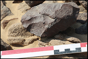
Raw-material exploitation in the Earlier and Middle Stone Age in the Eastern Desert of Egypt: evidence from Wadi Abu Subeira
-
- Article
-
- You have access
- Open access
- HTML
- Export citation
A TIME-INTEGRATED SAMPLER FOR RADIOCARBON ANALYSIS OF AQUATIC METHANE
-
- Journal:
- Radiocarbon / Volume 66 / Issue 2 / April 2024
- Published online by Cambridge University Press:
- 26 March 2024, pp. 421-435
- Print publication:
- April 2024
-
- Article
-
- You have access
- Open access
- HTML
- Export citation
FIRST DIRECT RADIOCARBON DATING (22–27 CAL KA BP) OF MASSIVE ICE AT THE MECHIGMEN AND LAVRENTIYA BAYS COAST, EASTERN CHUKOTKA
-
- Journal:
- Radiocarbon / Volume 66 / Issue 2 / April 2024
- Published online by Cambridge University Press:
- 26 March 2024, pp. 410-420
- Print publication:
- April 2024
-
- Article
- Export citation
Angara Style Rock Art: The Evolution of a Regional Emblematic and Syncretic Style
-
- Journal:
- Cambridge Archaeological Journal / Volume 34 / Issue 3 / August 2024
- Published online by Cambridge University Press:
- 26 March 2024, pp. 477-494
-
- Article
-
- You have access
- Open access
- HTML
- Export citation
Practical Heritage Management: Preserving a Tangible Past. Scott F. Anfinson. 2019. Rowman & Littlefield, Lanham, Maryland. xxiii + 514 pp. $171.00 (hardcover), ISBN 978-0-7591-1798-3. $80.00 (paperback), ISBN 978-0-7591-1799-0. $76.00 (e-book), ISBN 978-0-7591-1800-3.
-
- Journal:
- American Antiquity / Volume 89 / Issue 3 / July 2024
- Published online by Cambridge University Press:
- 25 March 2024, pp. 544-545
- Print publication:
- July 2024
-
- Article
- Export citation
Open paleoenvironment and dry climate in south India immediately before the Youngest Toba Tuff eruption (~75 ka) are suggested by Vondrichnus structures at the Jwalapuram locality, Jurreru valley
-
- Journal:
- Quaternary Research / Volume 121 / September 2024
- Published online by Cambridge University Press:
- 25 March 2024, pp. 132-140
-
- Article
- Export citation
MONITORING OF MODERN CARBON FRACTION IN DISPOSABLE PACKAGING
-
- Journal:
- Radiocarbon / Volume 66 / Issue 5 / October 2024
- Published online by Cambridge University Press:
- 25 March 2024, pp. 1032-1040
- Print publication:
- October 2024
-
- Article
- Export citation
Racial Discourses in Aegean Prehistory c. 1900: The Case of the Cupbearer Fresco at Knossos
-
- Journal:
- European Journal of Archaeology / Volume 27 / Issue 2 / May 2024
- Published online by Cambridge University Press:
- 25 March 2024, pp. 231-249
-
- Article
- Export citation
