Refine search
Actions for selected content:
95781 results in Archaeology
WHERE POWER LIES: LORDLY POWER CENTRES IN THE ENGLISH LANDSCAPE c. 800–1200
-
- Journal:
- The Antiquaries Journal / Volume 104 / October 2024
- Published online by Cambridge University Press:
- 09 January 2025, pp. 72-106
- Print publication:
- October 2024
-
- Article
-
- You have access
- Open access
- HTML
- Export citation
Giles Worsley Fellowship: Architectural authorship: the Mosque of Rome and Islamic Cultural Centre
-
- Journal:
- Papers of the British School at Rome / Volume 92 / October 2024
- Published online by Cambridge University Press:
- 18 December 2024, pp. 353-354
- Print publication:
- October 2024
-
- Article
- Export citation
INTERAMNA LIRENAS PROJECT (COMUNE DI PIGNATARO INTERAMNA, PROVINCIA DI FROSINONE, REGIONE LAZIO)
-
- Journal:
- Papers of the British School at Rome / Volume 92 / October 2024
- Published online by Cambridge University Press:
- 18 December 2024, pp. 342-345
- Print publication:
- October 2024
-
- Article
-
- You have access
- Open access
- HTML
- Export citation
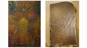
Giving rock art new life: combining past images, identity and contemporary art
-
- Article
-
- You have access
- HTML
- Export citation
Ties that Bind: The Long Emancipation and Status Ambiguity in Early Twentieth-Century Southwestern Tanzania
-
- Journal:
- American Antiquity / Volume 89 / Issue 4 / October 2024
- Published online by Cambridge University Press:
- 03 March 2025, pp. 608-626
- Print publication:
- October 2024
-
- Article
-
- You have access
- Open access
- HTML
- Export citation
FURFO PROJECT (BARISCIANO, L'AQUILA): THE 2023 SEASON
-
- Journal:
- Papers of the British School at Rome / Volume 92 / October 2024
- Published online by Cambridge University Press:
- 18 December 2024, pp. 338-342
- Print publication:
- October 2024
-
- Article
-
- You have access
- Open access
- HTML
- Export citation
London’s Waterfront and its World, 1666–1800. By John Schofield and Stephen Freeth, with contributions by Ian M Betts, Lyn Blackmore, Julian Bowsher and Alan Pipe. 290mm. Pp xi + 285, 208 figs (col throughout), 35 tabs. Archaeopress, Oxford, 2023. isbn 9781803276540. £50 (hbk). Available to download as an open access PDF from the Archaeopress website.
-
- Journal:
- The Antiquaries Journal / Volume 104 / October 2024
- Published online by Cambridge University Press:
- 31 January 2025, pp. 415-416
- Print publication:
- October 2024
-
- Article
- Export citation
OF ARMS AND THE GENTLEMAN: ROBERT FAYRFAX AND HIS FAMILY
-
- Journal:
- The Antiquaries Journal / Volume 104 / October 2024
- Published online by Cambridge University Press:
- 16 December 2024, pp. 206-234
- Print publication:
- October 2024
-
- Article
- Export citation
NOTES FROM ROME 2023–24
-
- Journal:
- Papers of the British School at Rome / Volume 92 / October 2024
- Published online by Cambridge University Press:
- 18 December 2024, pp. 311-324
- Print publication:
- October 2024
-
- Article
- Export citation
FALERII NOVI: THE FRINGES OF THE CITY
-
- Journal:
- Papers of the British School at Rome / Volume 92 / October 2024
- Published online by Cambridge University Press:
- 18 December 2024, pp. 335-338
- Print publication:
- October 2024
-
- Article
- Export citation
Positioning Maroon Archaeologies to Face Racial Violence in Ecuador
-
- Journal:
- American Antiquity / Volume 89 / Issue 4 / October 2024
- Published online by Cambridge University Press:
- 03 March 2025, pp. 664-682
- Print publication:
- October 2024
-
- Article
-
- You have access
- Open access
- HTML
- Export citation
Macquarie Gale Scholarship: The Trojan epic cycle within the Etruscan cultural identity/Etruscan scarab gems: new interpretations and approaches
-
- Journal:
- Papers of the British School at Rome / Volume 92 / October 2024
- Published online by Cambridge University Press:
- 18 December 2024, pp. 355-356
- Print publication:
- October 2024
-
- Article
- Export citation
ANT volume 104 Cover and Back matter
-
- Journal:
- The Antiquaries Journal / Volume 104 / October 2024
- Published online by Cambridge University Press:
- 31 January 2025, pp. b1-b2
- Print publication:
- October 2024
-
- Article
-
- You have access
- Export citation
Rome Fellowships: Political misfits in the Adriatic, 1918–1947
-
- Journal:
- Papers of the British School at Rome / Volume 92 / October 2024
- Published online by Cambridge University Press:
- 18 December 2024, pp. 359-360
- Print publication:
- October 2024
-
- Article
- Export citation
BOOKS KEPT AT THE SHRINE OF EDWARD THE CONFESSOR AT WESTMINSTER ABBEY IN THE LATE MIDDLE AGES
-
- Journal:
- The Antiquaries Journal / Volume 104 / October 2024
- Published online by Cambridge University Press:
- 25 October 2024, pp. 169-205
- Print publication:
- October 2024
-
- Article
- Export citation
An imperium in imperio: A Geospatial Analysis of Defensibility and Accessibility of Maroon Settlements in Dominica
-
- Journal:
- American Antiquity / Volume 89 / Issue 4 / October 2024
- Published online by Cambridge University Press:
- 03 March 2025, pp. 627-646
- Print publication:
- October 2024
-
- Article
-
- You have access
- Open access
- HTML
- Export citation
Re-Membering Our Impossible Worlds: Black Archaeology for Amazonian Africans
-
- Journal:
- American Antiquity / Volume 89 / Issue 4 / October 2024
- Published online by Cambridge University Press:
- 03 March 2025, pp. 553-573
- Print publication:
- October 2024
-
- Article
- Export citation
County Durham. By Martin Roberts, Nikolaus Pevsner and Elizabeth Williamson. 220mm. Pp xx + 880, 125 col ills, 64 figs, 11 maps. The Buildings of England series. Yale University Press, New Haven and London, 2021. isbn 9780300225044. £45 (hbk).
-
- Journal:
- The Antiquaries Journal / Volume 104 / October 2024
- Published online by Cambridge University Press:
- 14 January 2025, pp. 409-410
- Print publication:
- October 2024
-
- Article
- Export citation
