Refine search
Actions for selected content:
95781 results in Archaeology
Assessing the quality of citizen science in archaeological remote sensing: results from the Heritage Quest project in the Netherlands
-
- Article
-
- You have access
- Open access
- HTML
- Export citation
Restitution of African Cultural Heritage: Revisiting Natural Law Concepts of Statehood and Property in the Context of Colonial Spoliation
-
- Journal:
- International Journal of Cultural Property / Volume 31 / Issue 1 / February 2024
- Published online by Cambridge University Press:
- 14 October 2024, pp. 102-123
-
- Article
- Export citation
QUA volume 121 Cover and Front matter
-
- Journal:
- Quaternary Research / Volume 121 / September 2024
- Published online by Cambridge University Press:
- 10 October 2024, pp. f1-f4
-
- Article
-
- You have access
- Export citation
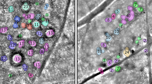
A spectral cavalcade: Early Iron Age horse sacrifice at a royal tomb in southern Siberia
- Part of
-
- Article
-
- You have access
- Open access
- HTML
- Export citation
LA CITTÀ DEL SILFIO. ISTITUZIONI, CULTI ED ECONOMIA DI CIRENE CLASSICA ED ELLENISTICA ATTRAVERSO LE FONTI EPIGRAFICHE By Emilio Rosamilia. Edizioni della Normale, Pisa, 2023. ISBN 9788876427367, pp. 453, 14 colour plates. Price: €40.00 (paperback)
-
- Journal:
- Libyan Studies / Volume 55 / November 2024
- Published online by Cambridge University Press:
- 07 October 2024, pp. 163-164
- Print publication:
- November 2024
-
- Article
- Export citation
Snake queens and political consolidation: How royal women helped create Kaan: A view from Waka’
-
- Journal:
- Ancient Mesoamerica / Volume 35 / Issue 3 / Fall 2024
- Published online by Cambridge University Press:
- 04 October 2024, pp. 766-783
-
- Article
-
- You have access
- Open access
- HTML
- Export citation
The rise, expansion, and endurance of Kaanul: The view from northwestern Peten
-
- Journal:
- Ancient Mesoamerica / Volume 35 / Issue 3 / Fall 2024
- Published online by Cambridge University Press:
- 04 October 2024, pp. 689-707
-
- Article
- Export citation
In search of the serpent kings: From Dzibanche to Calakmul
-
- Journal:
- Ancient Mesoamerica / Volume 35 / Issue 3 / Fall 2024
- Published online by Cambridge University Press:
- 04 October 2024, pp. 822-838
-
- Article
-
- You have access
- Open access
- HTML
- Export citation
New data, new interpretations: Dzibanche monuments through the lenses of a 3D scanner
-
- Journal:
- Ancient Mesoamerica / Volume 35 / Issue 3 / Fall 2024
- Published online by Cambridge University Press:
- 04 October 2024, pp. 708-725
-
- Article
-
- You have access
- Open access
- HTML
- Export citation
The team for a new age: Naranjo and Holmul under Kaanu'l's sway
-
- Journal:
- Ancient Mesoamerica / Volume 35 / Issue 3 / Fall 2024
- Published online by Cambridge University Press:
- 04 October 2024, pp. 784-805
-
- Article
-
- You have access
- Open access
- HTML
- Export citation
Los gobernantes de la dinastía Kaanu'l en Dzibanché, Quintana Roo, México
-
- Journal:
- Ancient Mesoamerica / Volume 35 / Issue 3 / Fall 2024
- Published online by Cambridge University Press:
- 04 October 2024, pp. 806-821
-
- Article
-
- You have access
- Open access
- HTML
- Export citation
The rise of the Kaanuˀl kingdom and the city of Dzibanche
-
- Journal:
- Ancient Mesoamerica / Volume 35 / Issue 3 / Fall 2024
- Published online by Cambridge University Press:
- 04 October 2024, pp. 726-747
-
- Article
-
- You have access
- Open access
- HTML
- Export citation
An account of the kings of Kanu'l as recorded on the hieroglyphic stair of K'an II of Caracol
-
- Journal:
- Ancient Mesoamerica / Volume 35 / Issue 3 / Fall 2024
- Published online by Cambridge University Press:
- 04 October 2024, pp. 748-765
-
- Article
- Export citation
Decolonizing Roman Imperialism
- The Study of Rome, Romanization, and the Postcolonial Lens
-
- Published online:
- 03 October 2024
- Print publication:
- 17 October 2024
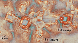
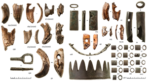
Running out of empty space: environmental lidar and the crowded ancient landscape of Campeche, Mexico
-
- Article
-
- You have access
- Open access
- HTML
- Export citation
LOST TREASURES RESURFACE: THE UNTOLD STORY OF THE SOCIETY OF ANTIQUARIES’ PRINTING PLATES
-
- Journal:
- The Antiquaries Journal / Volume 104 / October 2024
- Published online by Cambridge University Press:
- 11 December 2024, pp. 304-342
- Print publication:
- October 2024
-
- Article
-
- You have access
- Open access
- HTML
- Export citation
Late Medieval Bristol: time, space and power. By Peter Fleming. 245 mm. Pp x + 405, 15 col figs. Yorkist History Trust in association with Shaun Tyas, Donington, 2024. isbn 9781915774187. £25 (hbk). - The Lordship of Middleham in 1465 and 1473–4. Edited by Livia Visser-Fuchs, Jonathan Mackman and Anne F Sutton, with Introduction by Gladys Mary Coles and Transcript and Translation by Jonathan Mackman. 245 mm. Pp, x + 436, 2 figs and 5 tabs. Yorkist History Trust in association with Shaun Tyas, Donington, 2023. isbn 9781915774170. £25 (hbk).
-
- Journal:
- The Antiquaries Journal / Volume 104 / October 2024
- Published online by Cambridge University Press:
- 21 November 2024, pp. 413-415
- Print publication:
- October 2024
-
- Article
- Export citation
On the poverty of academic imagination: a response to Bentley & O'Brien
-
- Article
-
- You have access
- Open access
- HTML
- Export citation
