Refine search
Actions for selected content:
95781 results in Archaeology
The Pleistocene footprints are younger than we thought: correcting the radiocarbon dates of Ruppia seeds, Tularosa Basin, New Mexico
-
- Journal:
- Quaternary Research / Volume 117 / January 2024
- Published online by Cambridge University Press:
- 10 January 2024, pp. 67-78
-
- Article
- Export citation
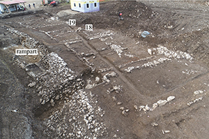
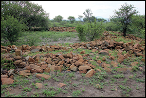
Inequality or insecurity? The case of pre-colonial farming communities in southern Africa
-
- Article
-
- You have access
- Open access
- HTML
- Export citation
Quaternary climatic events as conditioning factors of hydrogeologic characteristics and salinity in costal aquifers at northern Patagonia, Argentina
-
- Journal:
- Quaternary Research / Volume 119 / May 2024
- Published online by Cambridge University Press:
- 09 January 2024, pp. 152-161
-
- Article
- Export citation
New paleohydroclimate record of the MIS 5e/5d transition from Yelini Cave, central Anatolian region of Türkiye – ADDENDUM
-
- Journal:
- Quaternary Research / Volume 118 / March 2024
- Published online by Cambridge University Press:
- 08 January 2024, p. 218
-
- Article
-
- You have access
- Open access
- HTML
- Export citation
The Mustis arch and its dedication
-
- Journal:
- Libyan Studies / Volume 55 / November 2024
- Published online by Cambridge University Press:
- 08 January 2024, pp. 95-102
- Print publication:
- November 2024
-
- Article
-
- You have access
- Open access
- HTML
- Export citation
Towns and Commerce in Viking-Age Scandinavia
-
- Published online:
- 04 January 2024
- Print publication:
- 25 January 2024
Glacier fluctuation chronology since the latest Pleistocene at Mount Rainier, Washington, USA
-
- Journal:
- Quaternary Research / Volume 119 / May 2024
- Published online by Cambridge University Press:
- 03 January 2024, pp. 65-85
-
- Article
- Export citation
Sedimentological and geochemical traces of metallurgical activity in the Świślina River valley (central Poland) at the Doły Biskupie site
-
- Journal:
- Quaternary Research / Volume 119 / May 2024
- Published online by Cambridge University Press:
- 03 January 2024, pp. 1-11
-
- Article
- Export citation
Bioarchaeological Evidence of Violence between the Middle and Late Formative (500–400 BC) in the Peruvian North-Central Coast
-
- Journal:
- Latin American Antiquity / Volume 35 / Issue 4 / December 2024
- Published online by Cambridge University Press:
- 03 January 2024, pp. 853-869
- Print publication:
- December 2024
-
- Article
- Export citation
A prolonged dry Mid-Holocene recorded by Moon Lake in the Tengger Desert, arid and semiarid China
-
- Journal:
- Quaternary Research / Volume 117 / January 2024
- Published online by Cambridge University Press:
- 03 January 2024, pp. 43-53
-
- Article
- Export citation
Hillslope and vegetation response to postglacial warming at Bear Meadows Bog, Pennsylvania, USA
-
- Journal:
- Quaternary Research / Volume 117 / January 2024
- Published online by Cambridge University Press:
- 03 January 2024, pp. 79-97
-
- Article
-
- You have access
- Open access
- HTML
- Export citation
Examining the Seventeenth-Century Copper Trade: An Analysis of Smelted Copper from Sites in Virginia and North Carolina
-
- Journal:
- American Antiquity / Volume 89 / Issue 1 / January 2024
- Published online by Cambridge University Press:
- 23 January 2024, pp. 119-132
- Print publication:
- January 2024
-
- Article
-
- You have access
- Open access
- HTML
- Export citation
Editor's Corner
-
- Journal:
- American Antiquity / Volume 89 / Issue 1 / January 2024
- Published online by Cambridge University Press:
- 23 January 2024, p. 1
- Print publication:
- January 2024
-
- Article
-
- You have access
- HTML
- Export citation
The Luwian word for ‘city, town’
-
- Journal:
- Anatolian Studies / Volume 74 / 2024
- Published online by Cambridge University Press:
- 24 October 2024, pp. 47-73
- Print publication:
- 2024
-
- Article
-
- You have access
- Open access
- Export citation
J. David Hawkins 1940–2023
-
- Journal:
- Anatolian Studies / Volume 74 / 2024
- Published online by Cambridge University Press:
- 24 October 2024, pp. 1-2
- Print publication:
- 2024
-
- Article
-
- You have access
- Export citation
A spolia ostotheke from Metropolis and Early Christian burial traditions
-
- Journal:
- Anatolian Studies / Volume 74 / 2024
- Published online by Cambridge University Press:
- 24 October 2024, pp. 179-194
- Print publication:
- 2024
-
- Article
-
- You have access
- Open access
- Export citation
Lydian pottery in the Roman tradition: An archaeometric study of production at Sardis
-
- Journal:
- Anatolian Studies / Volume 74 / 2024
- Published online by Cambridge University Press:
- 24 October 2024, pp. 75-96
- Print publication:
- 2024
-
- Article
- Export citation
The sum of all victories? Reassessing a Sinopean victory catalogue (IK Sinope 105)
-
- Journal:
- Anatolian Studies / Volume 74 / 2024
- Published online by Cambridge University Press:
- 30 April 2024, pp. 155-177
- Print publication:
- 2024
-
- Article
- Export citation
Antiquity market trends in Anatolian figurines 1999–2022: Studies in price, prevalence and provenance
-
- Journal:
- Anatolian Studies / Volume 74 / 2024
- Published online by Cambridge University Press:
- 24 October 2024, pp. 223-245
- Print publication:
- 2024
-
- Article
- Export citation
