Refine search
Actions for selected content:
95781 results in Archaeology
A new look at an ancient city: An outline of the chronological and urban development of the Hittite capital Ḫattuša
-
- Journal:
- Anatolian Studies / Volume 74 / 2024
- Published online by Cambridge University Press:
- 30 April 2024, pp. 13-46
- Print publication:
- 2024
-
- Article
- Export citation
Coinage networks in fifth-century BCE Ionia
-
- Journal:
- Anatolian Studies / Volume 74 / 2024
- Published online by Cambridge University Press:
- 30 April 2024, pp. 97-127
- Print publication:
- 2024
-
- Article
-
- You have access
- Open access
- Export citation
ANK volume 74 Cover and Back matter
-
- Journal:
- Anatolian Studies / Volume 74 / 2024
- Published online by Cambridge University Press:
- 24 October 2024, pp. b1-b3
- Print publication:
- 2024
-
- Article
-
- You have access
- Export citation
AAQ volume 89 issue 1 Cover and Front matter
-
- Journal:
- American Antiquity / Volume 89 / Issue 1 / January 2024
- Published online by Cambridge University Press:
- 23 January 2024, pp. f1-f4
- Print publication:
- January 2024
-
- Article
-
- You have access
- Export citation
Female bodies and dynastic legitimacy in the Nereid Monument at Xanthos
-
- Journal:
- Anatolian Studies / Volume 74 / 2024
- Published online by Cambridge University Press:
- 10 May 2024, pp. 129-154
- Print publication:
- 2024
-
- Article
-
- You have access
- Open access
- Export citation
The Byzantine cave monastery of the Ilgarini mağarası (Paphlagonia) – the Chryse Petra of Nikon Metanoite?
-
- Journal:
- Anatolian Studies / Volume 74 / 2024
- Published online by Cambridge University Press:
- 09 May 2024, pp. 195-221
- Print publication:
- 2024
-
- Article
-
- You have access
- Open access
- Export citation
ANK volume 74 Cover and Front matter
-
- Journal:
- Anatolian Studies / Volume 74 / 2024
- Published online by Cambridge University Press:
- 24 October 2024, pp. f1-f3
- Print publication:
- 2024
-
- Article
-
- You have access
- Export citation
AAQ volume 89 issue 1 Cover and Back matter
-
- Journal:
- American Antiquity / Volume 89 / Issue 1 / January 2024
- Published online by Cambridge University Press:
- 23 January 2024, pp. b1-b5
- Print publication:
- January 2024
-
- Article
-
- You have access
- Export citation
THE INFLUENCE OF PLANT SPECIES AND PRETREATMENT ON THE 14C AGE OF CAREX-DOMINATED PEAT PLANTS OF A PEAT CORE FROM JINCHUAN MIRE, NE CHINA
-
- Journal:
- Radiocarbon / Volume 66 / Issue 5 / October 2024
- Published online by Cambridge University Press:
- 28 December 2023, pp. 937-957
- Print publication:
- October 2024
-
- Article
-
- You have access
- Open access
- HTML
- Export citation
“Lies My Teacher Told Me”: Overcoming the Ideal–Real Divide in Archaeological Collections Training
-
- Journal:
- Advances in Archaeological Practice / Volume 12 / Issue 1 / February 2024
- Published online by Cambridge University Press:
- 27 December 2023, pp. 5-12
-
- Article
-
- You have access
- Open access
- HTML
- Export citation
Sourcing Archaeological Lithic Assemblages: New Perspectives and Integrated Approaches. Charles A. Speer, Ryan M. Parish, and Gustavo Barrientos (editors). 2023. University of Utah Press, Salt Lake City. ix + 236 pp. $80.00 (hardcover), ISBN 978-1-64769-108-0. $64.00 (e-book), ISBN 978-1-64769-110-3.
-
- Journal:
- American Antiquity / Volume 89 / Issue 2 / April 2024
- Published online by Cambridge University Press:
- 27 December 2023, pp. 333-334
- Print publication:
- April 2024
-
- Article
- Export citation
Loess transportation surfaces in west-central Wisconsin, USA
-
- Journal:
- Quaternary Research / Volume 120 / July 2024
- Published online by Cambridge University Press:
- 27 December 2023, pp. 36-52
-
- Article
- Export citation
Vapaki: Ancestral O'Odham Platform Mounds of the Sonoran Desert. Glen E. Rice, Arleyn W. Simon, and Chris Loendorf, editors. 2023. University of Utah Press, Salt Lake City. xx + 305 pp. $80.00 (hardcover), ISBN 978-1-64769-117-2. $64.00 (e-book), ISBN 978-1-64769-119-6.
-
- Journal:
- American Antiquity / Volume 89 / Issue 2 / April 2024
- Published online by Cambridge University Press:
- 27 December 2023, pp. 328-330
- Print publication:
- April 2024
-
- Article
- Export citation
Sounds in context: Archaeoacoustical studies of instruments from Comalcalco and Jonuta, pre-Hispanic Maya sites
-
- Journal:
- Ancient Mesoamerica / Volume 35 / Issue 2 / Summer 2024
- Published online by Cambridge University Press:
- 22 December 2023, pp. 472-493
-
- Article
-
- You have access
- Open access
- HTML
- Export citation
The Royal Workshops of the Alhambra
- Industrial Activity in Early Modern Granada
-
- Published by:
- Boydell & Brewer
- Published online:
- 20 December 2023
- Print publication:
- 25 February 2022

The Founders project: evaluating the economic role of the ‘founder crops’ prior to the emergence of agriculture in southwest Asia
-
- Article
-
- You have access
- Open access
- HTML
- Export citation

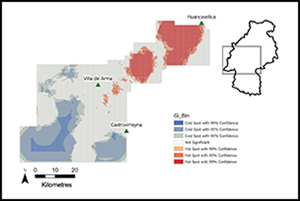
Managing pastoral landscapes: remote survey of herding infrastructure in Huancavelica, Peru
-
- Article
-
- You have access
- Open access
- HTML
- Export citation
