To save content items to your account,
please confirm that you agree to abide by our usage policies.
If this is the first time you use this feature, you will be asked to authorise Cambridge Core to connect with your account.
Find out more about saving content to .
To save content items to your Kindle, first ensure no-reply@cambridge.org
is added to your Approved Personal Document E-mail List under your Personal Document Settings
on the Manage Your Content and Devices page of your Amazon account. Then enter the ‘name’ part
of your Kindle email address below.
Find out more about saving to your Kindle.
Note you can select to save to either the @free.kindle.com or @kindle.com variations.
‘@free.kindle.com’ emails are free but can only be saved to your device when it is connected to wi-fi.
‘@kindle.com’ emails can be delivered even when you are not connected to wi-fi, but note that service fees apply.
Mumbai, earlier known as Bombay, has been described as the most ‘city-like city’ in India; some call it the urbs prima of India while others address it as the New York of the East. It was the ‘Gateway’ to India in colonial days and it remains so even today. In terms of population size within the municipal limits, Mumbai ranks second in the world. As an urban agglomeration, it ranks sixth among the large cities of the world. The ‘Vision Mumbai’ document prepared by McKinsey & Co. provides a blueprint for its transformation into a world city within the 2003-13 decade.
Mumbai, apart from being the capital of the state of Maharashtra, is the Indian financial capital and a dominant urban landscape of the western part of the ountry. Its nodal location in terms of land, sea and air connectivity, both national and international, adds to its magnetism as a leading industrial and commercial centre. It is the nerve centre of capital markets, financial services, and manufacturing, playing a crucial role in the growth and development of the Indian economy. It has attracted a large number of national and multinational firms since a long time. The exploitation of the offshore oilfields such as Bombay High and the city's key role in naval defence has enhanced its supremacy as a mega city of India.
Dhaka epitomises a long history of urbanisation influenced by various natural and cultural phases, at times hostile to its natural trend of evolutionary journey. Natural environment, the local culture, and the way of life of the people living there have together modified the urban landscape by adopting, adapting, and innovating in response to challenges posed and opportunities thrown open. A series of superimposed or juxtaposed layers of interventions due to these responses, sometimes beyond recognition, when unfolded, reveal an archetype deep beneath. In order to understand the contemporary urban morphology of Dhaka or to predict its future, it is essential to understand the process and context of its evolution.
GEO-ECOLOGICAL SETTING
The geography of a place has a profound effect on the settlement pattern, architecture, society, and thinking of the people living there. In the case of the People's Republic of Bangladesh this is more pronounced perhaps due to a low technological development and weak natural resources base, which have combined to force urban and traditional architectural developments along strictly modern and functional.
Calcutta's (now named Kolkata) settlement history is not that old. The origin of the settlement may be attributed to the middle of the seventeenth century. During that early period, traders of Saptagram (a port-city on the upstream of River Hooghly, located farther north to Bandel, at the confluence of River Saraswati and Jamuna, both now defunct) began to seek fresh markets as their original seat declined owing to the caprices of the rivers and, thus, a few families of Sheths and Bysaks moved southward, nearer to the sea-route to Bay of Bengal, and founded the village of Gobindapur on the east bank of River Hooghly, named after the Sheths' deity Gobindaji. Northward of this, they proceeded to set up the Sutanati Hat (or cotton and yarn market) by the side of Sutanati Ghat (boat landing platform by the riverside) which eventually attracted Job Charnok, the agent of British East India Company who landed there, in search of fresh fortune, on 24 August 1690. In between Sutanati and Gobindapur was the lesser settlement of Kalikata. These three villages became the site of the original British holdings that grew into the city of Calcutta. In fact, the right of renting these three villages was granted to British East India Company by the Sabarna Roychoudhuri family of Barisha-Behala (located at the southern suburb of the then Calcutta), who were holding the zamindari rights of the area, on 10 November 1698 for Rs. 1,300 only.
Kathmandu Metropolitan City (KMC), the capital and main business hub of Nepal, is also the largest urban centre of the country. Located in the lap of the Lesser (southern) Himalayas at the junction of 27.72° N latitude and 85.37° E longitude, it is spread over an area of 5,000 ha in Kathmandu Valley at an average elevation of 1,350 m. The KMC has 701,962 inhabitants, that is nearly one-fifth (20 per cent) of the urban population of the country (2001 census). It has a built-up area of 3,844.56 ha, and an average population density of 175.7 per/ha.
Kathmandu, also called Kantipur by Newars, is a derivative of the term Kashtamandap (kastha = wood; and mandap = temple) i.e. a temple made of wood (the trunk of a single tree). Everything in and around Kathmandu appears to have the imprint of the Kasthamandapa. The name of the valley is Kathmandu, and the district in which it is located is also called Kathmandu. The tentacles of the KMC, however, reach out to the neighbouring districts of Bhaktapur, and Lalitpur too.
For centuries, Nepal had three rival royal cities: Kathmandu, Bhaktapur, and Patan, all located in Kathmandu Valley. With the unification of Nepal under Prithvi Narayan Shah (1769-1775), Kathmandu scored over its rivals, became the capital of the kingdom, and grew steadily both in area and population. Today, its physical infrastructure – transport, communication, power, and housing – is comparable to any South Asian metropolis.
Delhi is the third-largest metropolis of India. It is growing fast both in terms of population and area, and is poised to become a global city in the near future. Delhi's population has grown from 2.38 million in 1911 to 12.79 million in 2001. In 2001, it was spread over 792 sq km, 18.3 times increase over its spatial extent a 43.3 sq km in 1911. It has surged ahead speedily in terms of its economic status as well. It is not only the centre of politics, but also of manufacturing and services. The per capita income of Delhi in 2001-02 was over INR 43,000 – double that of India's average per capita income.
The history of Delhi is rooted in the Mahabharata times; it was then known as Indraprastha, which according to popular belief was founded by the Pandavas. Coming down to the recorded history of Delhi, the Tomar Rajputs established the capital of their kingdom in the vicinity of Qutab Minar, in ad 736. They named it Lal Kot. When the Chauhans conquered Lal Kot, they renamed it as Quila Rai Pithora. Later, five more cities, within the geographical area of what is now known as Delhi, were created and eventually destroyed. They were: Siri, built by Alauddin Khilji, Tughlaqabad built by Ghiyasuddin Tughlaq, Jahanpanah built by Muhammad bin Tughlaq, Kotla Feroz Shah built by Firoz Shah Tughlaq, Dinpanah built by Humayun, and finally Shahjahanabad, around the Red Fort built by the Mughal emperor Shahjahan.
Kâbul, the capital and largest city of Afghanistan, is the economic and cultural hub of the country. Located on the Gateway to the ‘Fabulous East’, the tribal columns from Central and West Asia have occupied, passed through and trampled the city many a time. However, the worst times it witnessed was the Taliban Era (1978-2003), not because some foreign invaders trampled over it, but because its own people, the Afghans turned Mujahideens, turned Taliban, left nothing intact, not even minds and souls of the people. Here is an account of what I read about the city and what I saw during my visits during 2007-09.
Since 1978, Afghanis have been fighting against external forces as much as among themselves. Being the capital city, Kabul had to bear the destruction caused by marching armies and exploding bombs. The Mujahideen, the protectors of the faith, eventually succeeded in taking control of the country from Russian hands in 1992. Mohammad Nazibullah, the then pro-USSR president of the country, fearing capture and execution, took shelter in the UN Mission building. Taliban, the Millitia of Islamic Students, subdued other factions of the Mujahideen and gained control over Kabul in 1996. Najibullah was forcibly taken away from the UN Mission and executed in an open pavilion. The Taliban practiced a radical form of Sunni Islam that took strict stances on women, society, and even other sects of Muslims. They ruled over Afghanistan with an iron fist until their ouster by the American forces in 2001.
In tune with the basic civilisational ethos of the region, human
settlements of South Asia range from hamlets to great cities. The system of villages and cities evolved in the region changed with time. In the pages that follow, an attempt has been made to trace the ups and downs in the history of urbanisation in South Asia during the last 10,000 years or so. For the sake of convenience, we can divide it into seven phases:
Pre-Vedic Villagisation (7500-5000 bc)
Vedic Rurbanisation: (5000-2500 bc)
Indus Valley Civilisation: An Urban Interlude (2500-1500 bc)
Post-Vedic Rurbanisation: (2500 bc-1000 ad)
Medieval Transformation of Cities: (1000-1750 ad)
Colonial Urban Explosion: (1800-1947) and
Post-Independence Urban Explosion and Implosion (1947-2011).
PRE-VEDIC VILLAGISATION (7500-3500 bc)
It was around 5000 bc that the Vedas were composed by the Vedics who lived in the North-western region of the Indian sub-continent covering Persia, Afghanistan and Sind, Punjab, Haryana, Rajasthan, Gujarat and Uttar Pradesh in present-day India, and Pakistan. May be, the region extended further east but the changing courses of River Ganga and its tributaries have left little, if any traces of the past. The core of the region where Rig Veda, the first and oldest Veda was composed, was eastern Afghanistan and Sind, Punjab and the adjoining areas of India. The region was agriculturally prosperous. It was essentially rural.
This paper is divided into two broad sections. The first section deals with the Brahmaputra Valley in Assam (north east India) and its transformation into a frontier in the nineteenth century. The section also deals with how this process was closely linked to the re-interpretation of the region's relationship with Indo-Gangetic culture, and the impact on development of the modern ‘Assamese’ language. The second section interprets modern Assamese novels in the light of the issues raised in the first section. It explores how issues such as indigeneity, the concept of India and modern Assamese language, share a relation of conflict in modern Assamese fiction. It is suggested in the conclusion that, due to such historical specificities, the language and narrative of the frontier require a specific regional approach, and should not be subsumed within larger frameworks such as ‘the nation’ or ‘South Asia’.
Along with the establishment of the Department of Public Health in 1912, the implementation of public health policies became an integral part of city management in Republican Guangzhou. Yet the cholera outbreak of 1932 fully exposed the weaknesses of the medical and sanitary infrastructure of the city. Due to the Guangzhou government's inaction, the Fangbian Hospital, a local charitable hall founded in response to the bubonic plague of the 1890s, involuntarily took over the major responsibility for providing medical services for cholera patients in the early stage of the epidemic. Only after the death of hundreds of patients and Guangzhou being described as a ‘world of horror’ in the local press did the government-run hospital start to take a more active role. Epidemics have always served as catalysts for change in public health perceptions and practices. This paper attempts to explain how the cholera epidemic of 1932 changed the role of public health in the urban administration of the city. Emphasis is placed on analysing how the people of Guangzhou began to fight for a supply of clean drinking water once they came to realize the link between water and the spread of the fatal cholera epidemic in 1932. Clean water, which used to be seen as a commodity enjoyed by the privileged few, was now increasingly regarded as a citizen's right.
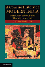
A Concise History of Modern India by Barbara D. Metcalf and Thomas R. Metcalf, has become a classic in the field since it was first published in 2001. As a fresh interpretation of Indian history from the Mughals to the present, it has informed students across the world. In the third edition of the book, a final chapter charts the dramatic developments of the last twenty years, from 1990 through the Congress electoral victory of 2009, to the rise of the Indian high-tech industry in a country still troubled by poverty and political unrest. The narrative focuses on the fundamentally political theme of the imaginative and institutional structures that have successively sustained and transformed India, first under British colonial rule and then, after 1947, as an independent country. Woven into the larger political narrative is an account of India's social and economic development and its rich cultural life.
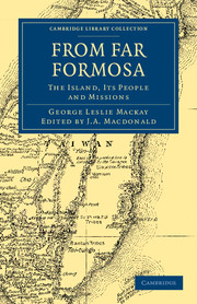
First published in 1896 and based on extracts from diaries, notes and reports, this work, edited by J. A. Macdonald, tells of the nearly three decades that George Mackay (1844–1901) spent on the island of Formosa (now Taiwan). In 1872 the Canadian Presbyterian priest arrived in northern Taiwan and set up a new missionary station. Within a month of his arrival he had made his first convert, a Chinese named Giam Chheng Hoa. Mackay married a local woman, with whom he had three children, and made numerous trips around the island, founded a hospital and established a college. He also gathered specimens of local fauna and flora that formed the cornerstone of a museum. Mackay offers vivid descriptions of Formosan geography, culture and animal life; his interpretation of the syncretic 'heathenism' of Formosa as a 'dark damning nightmare' is characteristic of the Western viewpoint of his time.
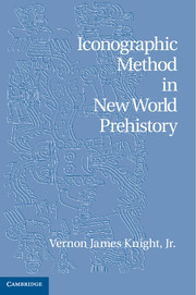
This book offers an overview of iconographic methods and their application to archaeological analysis. It offers a truly interdisciplinary approach that draws equally from art history and anthropology. Vernon James Knight, Jr begins with an historiographical overview, addressing the methodologies and theories that underpin both archaeology and art history. He then demonstrates how iconographic methods can be integrated with the scientific methods that are at the core of much archaeological inquiry. Focusing on artifacts from the pre-Columbian civilizations of North and Meso-American sites, Knight shows how the use of iconographic analysis yields new insights into these objects and civilizations.
Early twentieth-century Indian novels often depict the harsh material conditions of life under British colonial rule. Even so, these 'realist' novels are profoundly imaginative. In this study, Ulka Anjaria challenges the distinction between early twentieth-century social realism and modern-day magical realism, arguing that realism in the colony functioned as a mode of experimentation and aesthetic innovation – not merely as mimesis of the 'real world'. By examining novels from the 1930s across several Indian languages, Anjaria reveals how Indian authors used realist techniques to imagine alternate worlds, to invent new subjectivities and relationships with the Indian nation and to question some of the most entrenched values of modernity. Addressing issues of colonialism, Indian nationalism, the rise of Gandhi, religion and politics, and the role of literature in society, Anjaria's careful analysis will complement graduate study and research in English literature, South Asian studies and postcolonial studies.
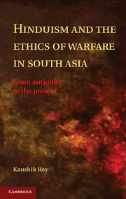
This book challenges the view, common among Western scholars, that precolonial India lacked a tradition of military philosophy. It traces the evolution of theories of warfare in India from the dawn of civilization, focusing on the debate between Dharmayuddha (Just War) and Kutayuddha (Unjust War) within Hindu philosophy. This debate centers around four questions: What is war? What justifies it? How should it be waged? And what are its potential repercussions? This body of literature provides evidence of the historical evolution of strategic thought in the Indian subcontinent that has heretofore been neglected by modern historians. Further, it provides a counterpoint to scholarship in political science that engages solely with Western theories in its analysis of independent India's philosophy of warfare. Ultimately, a better understanding of the legacy of ancient India's strategic theorizing will enable more accurate analysis of modern India's military and nuclear policies.
The concept of yinyang lies at the heart of Chinese thought and culture. The relationship between these two opposing, yet mutually dependent, forces is symbolized in the familiar black and white symbol that has become an icon in popular culture across the world. The real significance of yinyang is, however, more complex and subtle. This brilliant and comprehensive analysis by one of the leading authorities in the field captures the richness and multiplicity of the meanings and applications of yinyang, including its visual presentations. Through a vast range of historical and textual sources, the book examines the scope and role of yinyang, the philosophical significance of its various layers of meanings and its relation to numerous schools and traditions within Chinese (and Western) philosophy. By putting yinyang on a secure and clear philosophical footing, the book roots the concept in the original Chinese idiom, distancing it from Western assumptions, frameworks and terms, yet also seeking to connect its analysis to shared cross-cultural philosophical concerns.
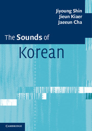
This introduction to the sounds of Korean is designed for English-speaking students with no prior knowledge of the language and includes online sound files, which demonstrate the sounds and pronunciation described. It will be an invaluable resource for students of Korean wanting to understand the basis of the current state of Korean phonetics and phonology, as well as for those studying Korean linguistics. Provides a complete and authoritative description and explanation of the current state of Korean phonetics and phonology Gives clear comparisons with English and provides practical advice on pronunciation Provides a wealth of authentic Korean examplesEach chapter contains exercises and Did you know? sections to help students put their knowledge into practice.