To save content items to your account,
please confirm that you agree to abide by our usage policies.
If this is the first time you use this feature, you will be asked to authorise Cambridge Core to connect with your account.
Find out more about saving content to .
To save content items to your Kindle, first ensure no-reply@cambridge.org
is added to your Approved Personal Document E-mail List under your Personal Document Settings
on the Manage Your Content and Devices page of your Amazon account. Then enter the ‘name’ part
of your Kindle email address below.
Find out more about saving to your Kindle.
Note you can select to save to either the @free.kindle.com or @kindle.com variations.
‘@free.kindle.com’ emails are free but can only be saved to your device when it is connected to wi-fi.
‘@kindle.com’ emails can be delivered even when you are not connected to wi-fi, but note that service fees apply.
The Hasselmann equation for the nonlinear interactions of deep-water gravity waves differs from other four-wave kinetic equations by the interaction coefficient. The explicit formula for this coefficient (e.g. Krasitskii, J. Fluid. Mech., vol. 272, 1994, pp. 1–20; Zakharov, Eur. J. Mech. B/Fluids, vol. 18. issue 3, 1999, pp. 327–344) is of great complexity and leaves its properties obscured. We provide analytical results for the behaviour of the coefficient in different domains. The Phillips curve and discrete interaction approximation-like quadruplets are studied in detail. The coupling coefficient for the long–short wave interactions is calculated and found to be surprisingly small. This smallness greatly reduces the non-locality of the interactions.
This study investigates the hydrodynamic interaction between a fully submerged buoyant pendulum and surface gravity waves, focusing on its primary and subharmonic resonance behaviour. The oscillatory motion of the pendulum is driven by fluid drag, with primary resonance occurring at the forcing frequency (viz. the wave frequency) and subharmonic resonance manifesting at half the forcing frequency. Both resonances exhibit nonlinear characteristics, including jump-up, jump-down phenomena and hysteresis. Furthermore, particle image velocimetry results reveal that the velocity fields of the surrounding fluid oscillate at the forcing frequency, confirming that subharmonic resonance is not induced by subharmonic excitation within the velocity field. Experimental observations are validated through both analytical and numerical methods, particularly within the primary and subharmonic resonance frequency ranges. The theoretical model describes the transverse motion of the pendulum using a nonlinear ordinary differential equation, with the method of multiple scales employed for the analytical solution. These analyses reveal the nonlinear characteristics of the system, e.g. bistable response of the primary/subharmonic resonances, and identify three distinct response regions based on the forcing frequency and amplitude. The system exhibits primary resonance regardless of the excitation strength; however, an unstable solution arises if the excitation level surpasses a specific threshold value. In contrast, subharmonic resonance is triggered only when the excitation amplitude exceeds a critical value. Furthermore, the experimental hysteresis curve confirms the theoretically predicted primary and subharmonic resonances, along with the jump-up and jump-down characteristics.
How to Decarbonize explores opportunities for decarbonization introduced by recent federal legislation, which has prompted state-level climate planning. It is designed for students and professionals whose work brings them into contact with these opportunities, even if climate is not their primary profession, including city managers, bankers, and home builders who are interested in participating in planning for decarbonization. Chapters aim to support the successful uptake of these policies by providing high-level views of these new decarbonization policies using social theory. The book is divided into four sections, each introducing a social theory about the organization of societies and how they change, and then providing examples to demonstrate the intricacies of implementation.
Hillslopes may be regarded as conveyor belts transferring water and sediment and nutrients to other parts of the geomorphic system. This chapter examines the mechanisms of, and the factors controlling, how far and how fast water, sediment and nutrients move along this conveyor belt, discussing water movement in and on hillslopes, fluid-gravity and sediment-gravity movement of sediment and nutrient movement. Hillslope processes do not operate in isolation, and the interaction, of connectivity among processes is also important. This interaction is particularly significant when assessing the importance of connectivity to understanding hillslopes within the context of landscape evolution. A full description of the connectivity of hillslope processes will require combined knowledge of both the magnitude–connectivity relationship, the probability distribution of event magnitudes and, to explain specific cases of functional connectivity, the actual sequence of events. In recent years there has been a growing recognition of the importance of connectivity in understanding the effects of hillslope processes. At best, however, that understanding remains patchy and incomplete.
In this chapter, we review the physical processes that affect the elevation of coastal settlements relative to the sea, and identify current and projected rates of change, describe the impacts of MSLR on coastal settlements and on small island states, provide rough estimates of the number of people exposed, identify options for in situ adaptation, describe common challenges in implementing planned relocations of communities at risk, with case studies from the Carteret Islands and Fiji, and conclude by reviewing the cascading risks faced in Bangladesh.
This chapter provides an introduction to climate-related migration and displacement in the distant and more recent past, an overview of the basic natural science processes behind anthropogenic climate change for readers that require one, a review of how the impacts of climate change in a general sense present risks to individuals, households and communities, and how vulnerability and adaptation shape these risks, a summary of the social science on how migration decisions are made and the general types of patterns and outcomes that emerge, and a consolidated picture of how climate hazards interact with non-climatic processes to shape migration and displacement.
Sustainable agricultural practices have become increasingly important due to growing environmental concerns and the urgent need to mitigate the climate crisis. Digital agriculture, through advanced data analysis frameworks, holds promise for promoting these practices. Pesticides are a common tool in agricultural pest control, which are key in ensuring food security but also significantly contribute to the climate crisis. To combat this, Integrated Pest Management (IPM) stands as a climate-smart alternative. We propose a causal and explainable framework for enhancing digital agriculture, using pest management and its sustainable alternative, IPM, as a key example to highlight the contributions of causality and explainability. Despite its potential, IPM faces low adoption rates due to farmers’ skepticism about its effectiveness. To address this challenge, we introduce an advanced data analysis framework tailored to enhance IPM adoption. Our framework provides (i) robust pest population predictions across diverse environments with invariant and causal learning, (ii) explainable pest presence predictions using transparent models, (iii) actionable advice through counterfactual explanations for in-season IPM interventions, (iv) field-specific treatment effect estimations, and (v) assessments of the effectiveness of our advice using causal inference. By incorporating these features, our study illustrates the potential of causality and explainability concepts to enhance digital agriculture regarding promoting climate-smart and sustainable agricultural practices, focusing on the specific case of pest management. In this case, our framework aims to alleviate skepticism and encourage wider adoption of IPM practices among policymakers, agricultural consultants, and farmers.
The present chapter focuses on migration and displacement associated with events that are directly linked to hotter air temperatures and/or an associated lack of moisture experienced at local and regional scales: droughts, increased aridity, desertification, heat, and wildfires. With the exception of wildfires – which share many characteristics comparable to rapid-onset extreme weather events – the hazards assessed in the present chapter are gradual in their onset and impacts. Their impacts accumulate with each passing week, month, and/or year, steadily eroding the water, food and/or livelihood security of households and communities. The slow rate of onset allows exposed populations an opportunity to adjust and adapt through means that do not require changes to existing mobility practices and patterns, sometimes referred to as in situ adaptation responses. It is only after hot and/or dry conditions persist beyond a particular threshold of duration and/or severity that in situ adaptations no longer prove to be sufficient and changes in migration decision-making and outcomes emerge.
Understanding how well critical source areas of water or sediment are connected to receiving surface waters, is an essential step towards improvement of land management. For this, it is important to quantify connectivity beyond the conceptual and proportional evaluation that most studies use connectivity for. Most studies measure only the potential of a landscape to allow connectivity to occur; or the connectivity that occurs at a given moment. This fact shows the two opportunities that will make it possible to monitor connectivity: assess the potential connectivity and the water and sediment fluxes through those landscapes. These components finally may result in the desired knowledge on the connectivity of the research area. In this chapter, we identify three spatial levels of connectivity: soil, hillslopes and catchments. In addition, to be able to measure and monitor connectivity the stocks and flow within every spatial level is introduced to allow for the identification of available techniques to actually assess connectivity at the given scale. The chapter ends with a set of key questions that need answering to make measuring connectivity on different scales reliable and useful.
This chapter discusses what is meant by connectivity in fluvial systems and how the connectivity approach differs from preceding research, the way in which it increases understanding of fluvial processes, and how knowledge of mechanisms and dynamics of processes fits into this framework. The focus is on longitudinal connectivity through river systems, mainly in large catchments and river channels and much of the attention is on sediment connectivity. The application of connectivity indices and graph theory are exemplified and the patterns, distributions and controls produced by connectivity analysis are demonstrated. Lateral connectivity is important in relation to the link of channels to floodplains and in maintaining functioning of wetlands. Recent developments of techniques and models have allowed additional factors to be incorporated and controls on connectivity of fluvial processes to be identified. The use of connectivity analysis as a framework is highly beneficial in management of fluvial systems and facilitates targeting of hotspots of sediment accumulation or depletion.
In this chapter, we review approaches to model climate-related migration including the multiple goals of modeling efforts and why modeling climate-related migration is of interest to researchers, commonly used sources of climate and migration data and data-related challenges, and various modeling methods used. The chapter is not meant to be an exhaustive inventory of approaches to modeling climate-related migration, but rather is intended to present the reader with an overview of the most common approaches and possible pitfalls associated with those approaches. We end the chapter with a discussion of some of the future directions and opportunities for data and modeling of climate-related migration.
Understanding firn densification is essential for interpreting ice core records, predicting ice sheet mass balance, elevation changes and future sea-level rise. Current models of firn densification on the Antarctic ice sheet (AIS), such as the Herron and Langway (1980) model are either simple semi-empirical models that rely on sparse climatic data and surface density observations or complex physics-based models that rely on poorly understood physics. In this work, we introduce a deep learning technique to study firn densification on the AIS. Our model, FirnLearn, evaluated on 225 cores, shows an average root-mean-square error of 31 kg m−3 and explained variance of 91%. We use the model to generate surface density and the depths to the 
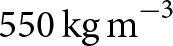
$550\,\mathrm{kg\,m}^{-3}$ and 
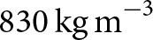
$830\,\mathrm{kg\,m}^{-3}$ density horizons across the AIS to assess spatial variability. Comparisons with the Herron and Langway (1980) model at ten locations with different climate conditions demonstrate that FirnLearn more accurately predicts density profiles in the second stage of densification and complete density profiles without direct surface density observations. This work establishes deep learning as a promising tool for understanding firn processes and advancing towards a universally applicable firn model.
Modelling connectivity is a three-stage process. Foremost, is the conceptualization of the connectivity problem. Two end-members of connectivity may be defined. The first considers connectivity to be an emergent property of a system. The second imposes on the system a specific definition of what connectivity is. The former conceptualisation is useful for applications where feedbacks between functional and structural connectivity occur over a shorter timescale than the duration of the model application, and for developing understanding based on model development and application. The latter is better used where prediction or application of the model results is required. It is further necessary to answer questions about space and time scales of the application and data available to support it. Once the basic units of spatial scale can be defined, development of the model can move on to considering what data are most appropriate at that scale, and how to collect them. In the final stage, different model structures that reflect the emerging and parameterized connectivity end-members are considered. The chapter gives examples of these stages with reference to modelling of water flows and consequent erosion.