Refine search
Actions for selected content:
95781 results in Archaeology
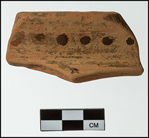
The Enmynveem mammoth and vegetation changes in arctic Chukotka during the Late Quaternary
-
- Journal:
- Quaternary Research / Volume 119 / May 2024
- Published online by Cambridge University Press:
- 26 February 2024, pp. 118-128
-
- Article
-
- You have access
- Open access
- HTML
- Export citation
Mediterranean Early Iron Age chronology: assessing radiocarbon dates from a stratified Geometric period deposit at Zagora (Andros), Greece
- Part of
-
- Article
-
- You have access
- Open access
- HTML
- Export citation
Trypillia mega-sites: a social levelling concept?
-
- Article
-
- You have access
- Open access
- HTML
- Export citation
Tropical vegetation productivity and atmospheric methane over the last 40,000 years from model simulations and stalagmites in Sulawesi, Indonesia
-
- Journal:
- Quaternary Research / Volume 118 / March 2024
- Published online by Cambridge University Press:
- 26 February 2024, pp. 126-141
-
- Article
-
- You have access
- Open access
- HTML
- Export citation
The Pleistocene ice-sheet dynamics in north-central Poland based on magnetic fabrics of tills and landform analysis
-
- Journal:
- Quaternary Research / Volume 119 / May 2024
- Published online by Cambridge University Press:
- 26 February 2024, pp. 99-117
-
- Article
- Export citation
Update and synthesis of the available archaeological and geochronological data for the Lower Paleolithic site of Loreto at Venosa (Basilicata, Italy)
-
- Journal:
- Quaternary Research / Volume 119 / May 2024
- Published online by Cambridge University Press:
- 23 February 2024, pp. 12-27
-
- Article
- Export citation

French historical and contemporary archaeology: a critical assessment
-
- Article
-
- You have access
- Open access
- HTML
- Export citation
Temperature fluctuations and ventilation dynamics induced by atmospheric pressure variations in Lamalunga Cave (Apulia, Italy) and their influences on speleothem growth
-
- Journal:
- Quaternary Research / Volume 118 / March 2024
- Published online by Cambridge University Press:
- 23 February 2024, pp. 100-115
-
- Article
-
- You have access
- Open access
- HTML
- Export citation
6 - The Mareotis Area
-
-
- Book:
- The Nile Delta
- Published online:
- 15 February 2024
- Print publication:
- 22 February 2024, pp 219-248
-
- Chapter
- Export citation
For Mona Abaza
-
- Book:
- The Nile Delta
- Published online:
- 15 February 2024
- Print publication:
- 22 February 2024, pp v-vi
-
- Chapter
- Export citation
10 - Alexandria
-
-
- Book:
- The Nile Delta
- Published online:
- 15 February 2024
- Print publication:
- 22 February 2024, pp 362-396
-
- Chapter
- Export citation
Index Locorum
-
- Book:
- Sicily and the Hellenistic Mediterranean World
- Published online:
- 27 January 2024
- Print publication:
- 22 February 2024, pp 385-390
-
- Chapter
- Export citation
Copyright page
-
- Book:
- The Nile Delta
- Published online:
- 15 February 2024
- Print publication:
- 22 February 2024, pp iv-iv
-
- Chapter
- Export citation
14 - Water Development in the Medieval Western Delta
-
-
- Book:
- The Nile Delta
- Published online:
- 15 February 2024
- Print publication:
- 22 February 2024, pp 466-491
-
- Chapter
- Export citation
Figures
-
- Book:
- Sicily and the Hellenistic Mediterranean World
- Published online:
- 27 January 2024
- Print publication:
- 22 February 2024, pp ix-xii
-
- Chapter
- Export citation
