Refine search
Actions for selected content:
95781 results in Archaeology
Tracking Mississippian Migrations from the Central Mississippi Valley to the Ridge and Valley with a Unified Absolute Chronology
-
- Journal:
- American Antiquity / Volume 89 / Issue 2 / April 2024
- Published online by Cambridge University Press:
- 07 March 2024, pp. 221-237
- Print publication:
- April 2024
-
- Article
-
- You have access
- Open access
- HTML
- Export citation
A Chronological Model for Inca Provincial Expansion: The Case of the Copiapo Valley
-
- Journal:
- Latin American Antiquity / Volume 36 / Issue 1 / March 2025
- Published online by Cambridge University Press:
- 07 March 2024, pp. 100-119
- Print publication:
- March 2025
-
- Article
- Export citation
Explorando la desigualdad social y sexual en contextos urbanos coloniales a través de la enfermedad degenerativa articular: El caso de Mendoza (Argentina)
-
- Journal:
- Latin American Antiquity / Volume 36 / Issue 1 / March 2025
- Published online by Cambridge University Press:
- 07 March 2024, pp. 21-38
- Print publication:
- March 2025
-
- Article
- Export citation
Power and Identity at the Margins of the Ancient Near East. 2023. Sara Mohr and Shane M. Thompson, editors. University Press of Colorado, Denver. xiv + 205 pp. $63.00 (hardcover), ISBN 978-1-64642-357-6. $50.00 (e-book), ISBN 978-1-64642-358-3.
-
- Journal:
- American Antiquity / Volume 89 / Issue 2 / April 2024
- Published online by Cambridge University Press:
- 05 March 2024, pp. 334-335
- Print publication:
- April 2024
-
- Article
- Export citation
The Fertile Earth and the Ordered Cosmos: Reflections on the Newark Earthworks and World Heritage. M. Elizabeth Weiser, Timothy R. W. Jordan, and Richard D. Shiels, editors. 2023. Ohio State University Press, Columbus. $24.95 (paperback), ISBN 978-0-8142-5870-5. $24.95 (e-book), ISBN 978-0-8142-8286-1.
-
- Journal:
- American Antiquity / Volume 89 / Issue 2 / April 2024
- Published online by Cambridge University Press:
- 04 March 2024, pp. 336-337
- Print publication:
- April 2024
-
- Article
- Export citation
A study on creative object biographies. Can creative arts be a medium for understanding object–human interaction?
-
- Journal:
- Archaeological Dialogues / Volume 30 / Issue 2 / December 2023
- Published online by Cambridge University Press:
- 04 March 2024, pp. 168-185
-
- Article
-
- You have access
- Open access
- HTML
- Export citation
Waka’ Stela 44 and the Early Classic Kaan hegemony
-
- Journal:
- Ancient Mesoamerica / Volume 35 / Issue 2 / Summer 2024
- Published online by Cambridge University Press:
- 04 March 2024, pp. 525-537
-
- Article
-
- You have access
- Open access
- HTML
- Export citation
Potting communities and conservatism in the Purépecha empire at Angamuco, Michoacán, Mexico
-
- Journal:
- Ancient Mesoamerica / Volume 35 / Issue 2 / Summer 2024
- Published online by Cambridge University Press:
- 04 March 2024, pp. 588-597
-
- Article
-
- You have access
- Open access
- HTML
- Export citation
Residue analysis suggests ritual use of tobacco at the ancient Mesoamerican city of Cotzumalhuapa, Guatemala
-
- Article
-
- You have access
- Open access
- HTML
- Export citation
POMPEY'S APULIAN ESTATES
-
- Journal:
- Papers of the British School at Rome / Volume 92 / October 2024
- Published online by Cambridge University Press:
- 04 March 2024, pp. 55-85
- Print publication:
- October 2024
-
- Article
- Export citation
Big enough to matter: on the frequency and chronology of giant handaxes in the British Lower Palaeolithic
-
- Article
-
- You have access
- Open access
- HTML
- Export citation
The Production and Distribution of Mimbres Pottery. Darrell G. Creel. 2022. University of New Mexico Press, Albuquerque. v + 279 pp. $85.00 (hardcover), ISBN 978-0-8263-6397-8. $85.00 (e-book), ISBN 978-0-8263-6398-5.
-
- Journal:
- American Antiquity / Volume 89 / Issue 2 / April 2024
- Published online by Cambridge University Press:
- 04 March 2024, pp. 330-331
- Print publication:
- April 2024
-
- Article
- Export citation
An Argaric Tomb for a Carpathian ‘Princess’?
-
- Journal:
- Cambridge Archaeological Journal / Volume 34 / Issue 3 / August 2024
- Published online by Cambridge University Press:
- 04 March 2024, pp. 495-510
-
- Article
-
- You have access
- Open access
- HTML
- Export citation
The duplication diacritic: A case study of variation and change in Mayan writing
-
- Journal:
- Ancient Mesoamerica / Volume 35 / Issue 2 / Summer 2024
- Published online by Cambridge University Press:
- 04 March 2024, pp. 562-587
-
- Article
- Export citation

Continuity and climate change: the Neolithic coastal settlement of Habonim North, Israel
-
- Article
-
- You have access
- Open access
- HTML
- Export citation
Lithic tool provisioning in the western Aztec provinces: A view from Calixtlahuaca
-
- Journal:
- Ancient Mesoamerica / Volume 35 / Issue 2 / Summer 2024
- Published online by Cambridge University Press:
- 04 March 2024, pp. 494-524
-
- Article
- Export citation
Network Science in Archaeology. Tom Brughmans and Matthew A. Peeples. 2023. Cambridge University Press, Cambridge. $130.00 (hardcover), ISBN 978-1-00917-066-6. $44.99 (paperback), ISBN 978-1-00917-064-2. $44.99 (e-book), ISBN 978-1-00918-615-5.
-
- Journal:
- American Antiquity / Volume 89 / Issue 2 / April 2024
- Published online by Cambridge University Press:
- 04 March 2024, pp. 327-328
- Print publication:
- April 2024
-
- Article
- Export citation
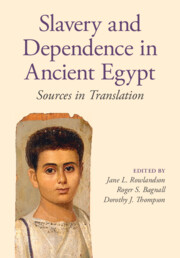
Slavery and Dependence in Ancient Egypt
- Sources in Translation
-
- Published online:
- 01 March 2024
- Print publication:
- 21 March 2024
LAQ volume 35 issue 1 Cover and Front matter
-
- Journal:
- Latin American Antiquity / Volume 35 / Issue 1 / March 2024
- Published online by Cambridge University Press:
- 21 March 2024, pp. f1-f4
- Print publication:
- March 2024
-
- Article
-
- You have access
- Export citation
