Refine search
Actions for selected content:
95781 results in Archaeology
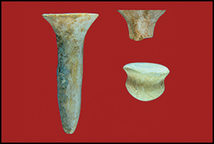
El Coyote, macroregional exchange, and Early Postclassic Mesoamerica
-
- Journal:
- Ancient Mesoamerica / Volume 35 / Issue 2 / Summer 2024
- Published online by Cambridge University Press:
- 13 March 2024, pp. 598-618
-
- Article
- Export citation
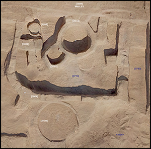
Dynamic Funerary Monuments of North-western Europe: Chronological Modelling of a Late Neolithic–Pre-Roman Iron Age Cemetery Complex at Mang de Bargen, Northern Germany
-
- Journal:
- Proceedings of the Prehistoric Society / Volume 90 / December 2024
- Published online by Cambridge University Press:
- 13 March 2024, pp. 105-125
- Print publication:
- December 2024
-
- Article
-
- You have access
- Open access
- HTML
- Export citation
Unraveling Island Economies through Organic Residue Analysis: The Case of Mocha Island (Southern Chile)
-
- Journal:
- Latin American Antiquity / Volume 35 / Issue 4 / December 2024
- Published online by Cambridge University Press:
- 12 March 2024, pp. 1003-1017
- Print publication:
- December 2024
-
- Article
-
- You have access
- Open access
- HTML
- Export citation
QUA volume 118 Cover and Front matter
-
- Journal:
- Quaternary Research / Volume 118 / March 2024
- Published online by Cambridge University Press:
- 12 March 2024, pp. f1-f4
-
- Article
-
- You have access
- Export citation
Wounded Animals and Where to Find Them. The Symbolism of Hunting in Palaeolithic Art
-
- Journal:
- Cambridge Archaeological Journal / Volume 34 / Issue 3 / August 2024
- Published online by Cambridge University Press:
- 12 March 2024, pp. 511-529
-
- Article
-
- You have access
- Open access
- HTML
- Export citation
Introduction to special issue: new developments in speleothem paleoclimate and paleoenvironmental science
-
- Journal:
- Quaternary Research / Volume 118 / March 2024
- Published online by Cambridge University Press:
- 12 March 2024, p. 1
-
- Article
- Export citation
Blood, obsidian, and the Teotihuacan cult of the mirror
-
- Journal:
- Ancient Mesoamerica / Volume 35 / Issue 2 / Summer 2024
- Published online by Cambridge University Press:
- 12 March 2024, pp. 451-471
-
- Article
-
- You have access
- Open access
- HTML
- Export citation
A new MIS 5 to MIS 2 speleothem record from Sandkraal Cave on the South African Cape south coast
-
- Journal:
- Quaternary Research / Volume 118 / March 2024
- Published online by Cambridge University Press:
- 12 March 2024, pp. 142-161
-
- Article
-
- You have access
- Open access
- HTML
- Export citation
Cryogenic features and stages in Late Quaternary subaerial sediments of the Lower Volga region
-
- Journal:
- Quaternary Research / Volume 120 / July 2024
- Published online by Cambridge University Press:
- 11 March 2024, pp. 3-17
-
- Article
- Export citation
Water and the Afterlife – Water-related Resources in the Burial Construction of the Nordic Bronze Age
-
- Journal:
- Proceedings of the Prehistoric Society / Volume 90 / December 2024
- Published online by Cambridge University Press:
- 11 March 2024, pp. 63-83
- Print publication:
- December 2024
-
- Article
-
- You have access
- Open access
- HTML
- Export citation
Texts, Politics and Identities: New Challenges on Iron Age Ethnicity. A Case from Northwest Iberia
-
- Journal:
- Cambridge Archaeological Journal / Volume 34 / Issue 4 / November 2024
- Published online by Cambridge University Press:
- 11 March 2024, pp. 567-582
-
- Article
-
- You have access
- Open access
- HTML
- Export citation
An Anarchist Archaeology of Equality: Pasts and Futures Against Hierarchy
-
- Journal:
- Cambridge Archaeological Journal / Volume 34 / Issue 4 / November 2024
- Published online by Cambridge University Press:
- 11 March 2024, pp. 531-545
-
- Article
-
- You have access
- Open access
- HTML
- Export citation
Bodily boundaries transgressed: corporal alteration through ornamentation in the Pre-Pottery Neolithic at Boncuklu Tarla, Türkiye
-
- Article
-
- You have access
- Open access
- HTML
- Export citation
After the fall of the Egyptian Empire: review of the Third Intermediate Period settlement at Tell el-Retaba
-
- Article
-
- You have access
- Open access
- HTML
- Export citation
Estrategias de aprovisionamiento de otáridos en la margen meridional de Tierra del Fuego durante el Holoceno
-
- Journal:
- Latin American Antiquity / Volume 35 / Issue 4 / December 2024
- Published online by Cambridge University Press:
- 08 March 2024, pp. 835-852
- Print publication:
- December 2024
-
- Article
- Export citation
Faire l'histoire d'Antioche sur l'Oronte - K. M. Neumann 2021. Antioch in Syria: A History from Coins (300 BCE–450 CE). Cambridge and New York: Cambridge University Press. - A. U. De Giorgi, et A. A. Eger. 2021. Antioch: A History. London: Routledge/New York: Taylor & Francis.
-
- Journal:
- Journal of Roman Archaeology / Volume 37 / Issue 1 / June 2024
- Published online by Cambridge University Press:
- 08 March 2024, pp. 379-395
- Print publication:
- June 2024
-
- Article
- Export citation
Archaeology of the Roman Conquest
- Tracing the Legions, Reclaiming the Conquered
-
- Published online:
- 07 March 2024
- Print publication:
- 04 April 2024
-
- Element
- Export citation
Mobile Landscapes and Their Enduring Places
-
- Published online:
- 07 March 2024
- Print publication:
- 04 April 2024
-
- Element
- Export citation
SEA BROUGHT ONTO LAND: SEASCAPE IMAGERY IN THE CYCLADIC POTTERY FROM PHYLAKOPI (MELOS) IN THE NATIONAL ARCHAEOLOGICAL MUSEUM, ATHENS
-
- Journal:
- Annual of the British School at Athens / Volume 119 / December 2024
- Published online by Cambridge University Press:
- 07 March 2024, pp. 61-81
- Print publication:
- December 2024
-
- Article
- Export citation
Obsidian Procurement and Exchange at the Apogee of Empire: Wari Political Economy in Arequipa, Peru
-
- Journal:
- Latin American Antiquity / Volume 36 / Issue 1 / March 2025
- Published online by Cambridge University Press:
- 07 March 2024, pp. 160-180
- Print publication:
- March 2025
-
- Article
-
- You have access
- Open access
- HTML
- Export citation
