Refine search
Actions for selected content:
580 results
Haughey’s Fort: a major complex of power, production and ritual in Late Bronze Age Europe
-
- Journal:
- Antiquity , First View
- Published online by Cambridge University Press:
- 30 June 2026, pp. 1-18
-
- Article
-
- You have access
- Open access
- HTML
- Export citation
Chapter 1 - Roman Rural Archaeology: Past, Present, and Future
-
-
- Book:
- Roman Rural Archaeology
- Published online:
- 01 June 2026
- Print publication:
- 25 June 2026, pp 1-12
-
- Chapter
- Export citation
Revisiting the July 1954 melt event in Northwest Greenland: What it tells us about the historical record of melt events on the Greenland ice sheet
-
- Journal:
- Journal of Glaciology / Volume 72 / 2026
- Published online by Cambridge University Press:
- 10 June 2026, e60
-
- Article
-
- You have access
- Open access
- HTML
- Export citation
Structured monitoring enhances regional trend and abundance estimates for Pygoscelis penguins around the Antarctic Peninsula
-
- Journal:
- Antarctic Science , First View
- Published online by Cambridge University Press:
- 05 June 2026, pp. 1-7
-
- Article
-
- You have access
- Open access
- HTML
- Export citation
Vanishing small glaciers in the Cordillera Real, Bolivia (1998–2024)
- Part of
-
- Journal:
- Annals of Glaciology / Volume 67 / 2026
- Published online by Cambridge University Press:
- 26 May 2026, e21
-
- Article
-
- You have access
- Open access
- HTML
- Export citation
An overview of the NASA Adaptation and Response in Drylands field experiment scoping study
-
- Journal:
- Cambridge Prisms: Drylands / Volume 3 / 2026
- Published online by Cambridge University Press:
- 26 May 2026, e22
-
- Article
-
- You have access
- Open access
- HTML
- Export citation
Surface expression of low basal friction upstream of Antarctic grounding lines
- Part of
-
- Journal:
- Annals of Glaciology / Volume 67 / 2026
- Published online by Cambridge University Press:
- 22 May 2026, e22
-
- Article
-
- You have access
- Open access
- HTML
- Export citation

Physical-Geometric Optics for Light-Scattering by Nonspherical Particles
- Applications to Remote Sensing and Climate Science
-
- Published online:
- 18 May 2026
- Print publication:
- 14 May 2026
Vanishing of very small glacierets throughout the Northern and Central Andes of Chile
- Part of
-
- Journal:
- Annals of Glaciology / Volume 67 / 2026
- Published online by Cambridge University Press:
- 13 May 2026, e20
-
- Article
-
- You have access
- Open access
- HTML
- Export citation
-
Small glaciers (
 ${ \lt }0.5\,\mathrm{km}^2$), glacierets (
 ${ \lt }0.25\,\mathrm{km}^2$) and, in particular, very small glacierets (
 ${ \lt }0.01\,\mathrm{km}^2$), despite being numerous in mountain environments, are underrepresented in scientific inquiry when assessing their response to climate change. We present new insights into the vanishing (no visible surface ice whilst underlain by bedrock or water) of 77 very small glacierets distributed in the Northern and Central Andes of Chile. We also analyse the presumable vanishing (no visible surface ice whilst underlain by regolith) of 244 additional very small glacierets, comprising a total dataset of 321 very small glacierets within the study area, equivalent to the loss of
 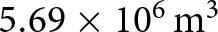 $5.69\times 10^6\,\mathrm{m}^3$ of water equivalent ice volume according to the 2022 Chilean Public Glacier Inventory. Our results show that 45.5% of the sample shrank from individually small glaciers at the beginning of the 21st century, whereas 53.0% of the sample vanished after being fragmented from larger glaciers in the same time span. The observed generalised reduction behaviour and vanishing results after extremely dry conditions at the end of the 2009–2022 Central Andes megadrought. We discuss our results in terms of the minimum area threshold for classifying very small glacierets, and whether their vanishing poses a hydrological impact.


The water management around the Urartian fortress of Argishtikhinili, Armenia
-
- Journal:
- Antiquity , First View
- Published online by Cambridge University Press:
- 13 May 2026, pp. 1-8
-
- Article
-
- You have access
- Open access
- HTML
- Export citation
Spatiotemporal modelling assessment of land-cover dynamics in a Srinagar (India) wetland from 1991 to 2031
-
- Journal:
- Environmental Conservation , First View
- Published online by Cambridge University Press:
- 06 May 2026, pp. 1-6
-
- Article
- Export citation
Automatic detection of glacier surges from ICESat-2 altimetry in Svalbard
-
- Journal:
- Journal of Glaciology / Volume 72 / 2026
- Published online by Cambridge University Press:
- 20 April 2026, e50
-
- Article
-
- You have access
- Open access
- HTML
- Export citation
Deep Learning–Based Detection of Ancient Agricultural Terraces Using Multisensor Data Fusion: A Case Study from the Bozburun Peninsula, Turkey
-
- Journal:
- Advances in Archaeological Practice / Volume 14 / Issue 2 / May 2026
- Published online by Cambridge University Press:
- 30 March 2026, pp. 198-217
-
- Article
-
- You have access
- Open access
- HTML
- Export citation
Multi-sensor comparison for snow grain size mapping from UAS platforms
-
- Journal:
- Journal of Glaciology / Volume 72 / 2026
- Published online by Cambridge University Press:
- 30 March 2026, e62
-
- Article
-
- You have access
- Open access
- HTML
- Export citation
7 - Terrestrial Environmental Data Obtained from Space
- from Part III
-
-
- Book:
- The Environmental Knowledge Commons
- Published online:
- 19 March 2026
- Print publication:
- 26 March 2026, pp 146-162
-
- Chapter
-
- You have access
- Open access
- HTML
- Export citation
Seasonal variability in ice velocity driven by subglacial hydrology of Drang Drung Glacier, Western Himalayas
-
- Journal:
- Journal of Glaciology / Volume 72 / 2026
- Published online by Cambridge University Press:
- 25 March 2026, e44
-
- Article
-
- You have access
- Open access
- HTML
- Export citation
-
Seasonal glacier dynamics are key to predicting hazards and glacier stability due to short-term events as well as improving glacier models. However, the short-term ice velocity variations remain poorly constrained for slow-moving glaciers in the Himalaya due to the scarcity of in situ observations and limitations of satellite data and methods. We present seasonal velocity variations of Drang Drung Glacier (western Himalaya) in 2021 using Sentinel-1 phase-based Interferometric Synthetic Aperture Radar and offset tracking. Smoothed velocity estimates reveal
 $\sim$400 % seasonal variability (3–13 m a
 $^{-1}$), with speedups in spring and autumn and slowdowns in summer and winter. We relate these patterns to changes in radar backscatter and seasonal widening of the proglacial stream observed in Planet imagery. To interpret the mechanisms, we simulate the evolution with the Subglacial Hydrology and Kinetic Transient Interactions model coupled to the Ice-sheet and Sea-level System Model. Results indicate that speedup–slowdown cycles and their upglacier migration are driven by meltwater-induced shifts in subglacial drainage efficiency. This study emphasizes the role of hydrology and basal sliding in Himalayan glacier dynamics, often oversimplified in existing models.


Recurrent surge dynamics and ongoing acceleration at Devon Ice Cap’s Southeast basin, Canadian Arctic
-
- Journal:
- Journal of Glaciology / Volume 72 / 2026
- Published online by Cambridge University Press:
- 24 March 2026, e35
-
- Article
-
- You have access
- Open access
- HTML
- Export citation
When has a glacier disappeared?
- Part of
-
- Journal:
- Annals of Glaciology / Volume 67 / 2026
- Published online by Cambridge University Press:
- 06 March 2026, e18
-
- Article
-
- You have access
- Open access
- HTML
- Export citation
Seasonal grounding line migration at Orville Coast, West Antarctica, based on a 4.5-year Sentinel-1 time series
-
- Journal:
- Journal of Glaciology / Volume 72 / 2026
- Published online by Cambridge University Press:
- 02 March 2026, e24
-
- Article
-
- You have access
- Open access
- HTML
- Export citation
Northernmost no more? The fragmentation of Nordmannsjøkelen in Norway
- Part of
-
- Journal:
- Annals of Glaciology / Volume 67 / 2026
- Published online by Cambridge University Press:
- 23 February 2026, e12
-
- Article
-
- You have access
- Open access
- HTML
- Export citation
