Refine search
Actions for selected content:
95781 results in Archaeology
NONREDUCTIVE THEORIES OF SENSE-PERCEPTION IN THE PHILOSOPHY OF KALĀM
-
- Journal:
- Arabic Sciences and Philosophy / Volume 34 / Issue 1 / March 2024
- Published online by Cambridge University Press:
- 12 February 2024, pp. 95-117
- Print publication:
- March 2024
-
- Article
-
- You have access
- Open access
- Export citation
A New Naming Convention for Andean Khipus
-
- Journal:
- Latin American Antiquity / Volume 35 / Issue 4 / December 2024
- Published online by Cambridge University Press:
- 12 February 2024, pp. 1039-1044
- Print publication:
- December 2024
-
- Article
- Export citation
The archaeology of childhood in the Etruscan-Italic world - E. Govi, ed. 2021. Birth: archeologia dell'infanzia nell'Italia preromana, 2 vols. Collana Disci. Bologna: Bononia University Press. Pp. 930, figs. ISBN 978-8-8692-3884-0.
-
- Journal:
- Journal of Roman Archaeology / Volume 37 / Issue 1 / June 2024
- Published online by Cambridge University Press:
- 12 February 2024, pp. 350-356
- Print publication:
- June 2024
-
- Article
- Export citation
ASP volume 34 issue 1 Cover and Back matter
-
- Journal:
- Arabic Sciences and Philosophy / Volume 34 / Issue 1 / March 2024
- Published online by Cambridge University Press:
- 12 February 2024, pp. b1-b4
- Print publication:
- March 2024
-
- Article
-
- You have access
- Export citation
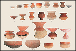
Aggrandisers and the first copper-base metallurgy in Southeast Asia
-
- Article
-
- You have access
- Open access
- HTML
- Export citation
LES ŠĪʿITES DANS LES MAQĀLĀT D'AL-BALḪĪ ET AL-AŠʿARĪ: TRANSMISSIONS TEXTUELLES ET ENJEUX HISTORIOGRAPHIQUES
-
- Journal:
- Arabic Sciences and Philosophy / Volume 34 / Issue 1 / March 2024
- Published online by Cambridge University Press:
- 12 February 2024, pp. 37-73
- Print publication:
- March 2024
-
- Article
- Export citation
NOUVEAUX FRAGMENTS DE KITĀB AL-FUTYĀ D'AL-ǦĀḤIẒ DANS LES MAQĀLĀT D'ABŪ AL-QĀSIM AL-BALḪĪ
-
- Journal:
- Arabic Sciences and Philosophy / Volume 34 / Issue 1 / March 2024
- Published online by Cambridge University Press:
- 12 February 2024, pp. 1-35
- Print publication:
- March 2024
-
- Article
- Export citation
A Concise History of the Aztecs
-
- Published online:
- 08 February 2024
- Print publication:
- 15 February 2024
1 - Perspectivism
-
- Book:
- Perspectivism in Archaeology
- Published online:
- 01 February 2024
- Print publication:
- 08 February 2024, pp 1-26
-
- Chapter
- Export citation
Abbreviations
-
- Book:
- Perspectivism in Archaeology
- Published online:
- 01 February 2024
- Print publication:
- 08 February 2024, pp xxxvii-xxxviii
-
- Chapter
- Export citation
Contents
-
- Book:
- Perspectivism in Archaeology
- Published online:
- 01 February 2024
- Print publication:
- 08 February 2024, pp vii-vii
-
- Chapter
- Export citation
7 - Perspectivism and Archaeology
-
- Book:
- Perspectivism in Archaeology
- Published online:
- 01 February 2024
- Print publication:
- 08 February 2024, pp 180-188
-
- Chapter
- Export citation
East Asian monsoon variations in the loess–desert transitional zone (northern China) during the past 14 ka and their comparison with TraCE21K simulation results
-
- Journal:
- Quaternary Research / Volume 120 / July 2024
- Published online by Cambridge University Press:
- 08 February 2024, pp. 53-61
-
- Article
- Export citation
Dedication
-
- Book:
- Perspectivism in Archaeology
- Published online:
- 01 February 2024
- Print publication:
- 08 February 2024, pp v-vi
-
- Chapter
- Export citation
Foreword
-
- Book:
- Perspectivism in Archaeology
- Published online:
- 01 February 2024
- Print publication:
- 08 February 2024, pp xi-xii
-
- Chapter
- Export citation
ADVANCING ANTARCTIC SEDIMENT CHRONOLOGY THROUGH COMBINED RAMPED PYROLYSIS OXIDATION AND PYROLYSIS-GC-MS
-
- Journal:
- Radiocarbon / Volume 66 / Issue 5 / October 2024
- Published online by Cambridge University Press:
- 08 February 2024, pp. 1120-1139
- Print publication:
- October 2024
-
- Article
- Export citation
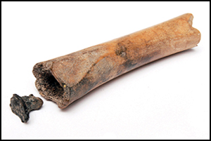
Evidence of the intentional use of black henbane (Hyoscyamus niger) in the Roman Netherlands
-
- Article
-
- You have access
- Open access
- HTML
- Export citation
References
-
- Book:
- Perspectivism in Archaeology
- Published online:
- 01 February 2024
- Print publication:
- 08 February 2024, pp 189-220
-
- Chapter
- Export citation
3 - Perspectivism, Materials and Objects
-
- Book:
- Perspectivism in Archaeology
- Published online:
- 01 February 2024
- Print publication:
- 08 February 2024, pp 62-86
-
- Chapter
- Export citation
2 - Perspectivism as a Theory
-
- Book:
- Perspectivism in Archaeology
- Published online:
- 01 February 2024
- Print publication:
- 08 February 2024, pp 27-61
-
- Chapter
- Export citation
