Refine search
Actions for selected content:
95781 results in Archaeology
Four - Local Identities and Local Networks
-
- Book:
- Religious Architecture and Roman Expansion
- Published online:
- 06 March 2025
- Print publication:
- 06 March 2025, pp 104-173
-
- Chapter
- Export citation
Works Cited
-
- Book:
- Religious Architecture and Roman Expansion
- Published online:
- 06 March 2025
- Print publication:
- 06 March 2025, pp 239-264
-
- Chapter
- Export citation
Two - Chronological Uncertainties and the “Romanization” Tangle
-
- Book:
- Religious Architecture and Roman Expansion
- Published online:
- 06 March 2025
- Print publication:
- 06 March 2025, pp 31-56
-
- Chapter
- Export citation

Beginning of the circle? Revised chronologies for Flagstones and Alington Avenue, Dorchester, Dorset
-
- Article
-
- You have access
- Open access
- HTML
- Export citation
Dedication
-
- Book:
- Religious Architecture and Roman Expansion
- Published online:
- 06 March 2025
- Print publication:
- 06 March 2025, pp v-vi
-
- Chapter
- Export citation
Six - Reframing and Remediating
-
- Book:
- Religious Architecture and Roman Expansion
- Published online:
- 06 March 2025
- Print publication:
- 06 March 2025, pp 203-230
-
- Chapter
- Export citation
One - Introduction
-
- Book:
- Religious Architecture and Roman Expansion
- Published online:
- 06 March 2025
- Print publication:
- 06 March 2025, pp 1-30
-
- Chapter
- Export citation
Afterlife Cycles, Cosmology, and Social Integration: Burial Practices in the Lower Ulúa Valley
-
- Journal:
- Ancient Mesoamerica / Volume 36 / Issue 1 / April 2025
- Published online by Cambridge University Press:
- 06 March 2025, pp. 30-55
-
- Article
-
- You have access
- Open access
- HTML
- Export citation
Five - Inventing History, Inventing Identity
-
- Book:
- Religious Architecture and Roman Expansion
- Published online:
- 06 March 2025
- Print publication:
- 06 March 2025, pp 174-202
-
- Chapter
- Export citation
Three - The Power of the Past
-
- Book:
- Religious Architecture and Roman Expansion
- Published online:
- 06 March 2025
- Print publication:
- 06 March 2025, pp 57-103
-
- Chapter
- Export citation
Copyright page
-
- Book:
- Religious Architecture and Roman Expansion
- Published online:
- 06 March 2025
- Print publication:
- 06 March 2025, pp iv-iv
-
- Chapter
- Export citation
Acknowledgments
-
- Book:
- Religious Architecture and Roman Expansion
- Published online:
- 06 March 2025
- Print publication:
- 06 March 2025, pp ix-xii
-
- Chapter
- Export citation
Toward Legal, Ethical, and Culturally Informed Care of Animal Remains in American Museum Collections
-
- Journal:
- Advances in Archaeological Practice / Volume 12 / Issue 4 / November 2024
- Published online by Cambridge University Press:
- 06 March 2025, pp. 416-423
-
- Article
-
- You have access
- Open access
- HTML
- Export citation
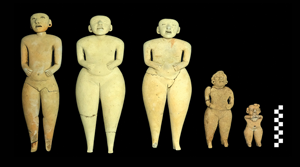
Of puppets and puppeteers: Preclassic clay figurines from San Isidro, El Salvador
-
- Article
-
- You have access
- Open access
- HTML
- Export citation
Overcoming Dichotomies with Heritage: Community Conversations and Collecting Data on the Florida Gulf Coast in an Era of Rising Sea Levels
-
- Journal:
- Advances in Archaeological Practice / Volume 12 / Issue 3 / August 2024
- Published online by Cambridge University Press:
- 04 March 2025, pp. 302-312
-
- Article
-
- You have access
- Open access
- HTML
- Export citation
Foreword: Monitoring Heritage at Risk Sites in Rapidly Changing Coastal Environments: Examples from the Southeastern United States and Beyond
-
- Journal:
- Advances in Archaeological Practice / Volume 12 / Issue 3 / August 2024
- Published online by Cambridge University Press:
- 04 March 2025, pp. 179-184
-
- Article
-
- You have access
- Open access
- HTML
- Export citation
Monitoring Shoreline Erosion at Calusa Island: A Community-Accessible Method
-
- Journal:
- Advances in Archaeological Practice / Volume 12 / Issue 3 / August 2024
- Published online by Cambridge University Press:
- 04 March 2025, pp. 289-301
-
- Article
-
- You have access
- HTML
- Export citation
North American Heritage at Risk (NAHAR) Research Pipeline and Collaborative Community
-
- Journal:
- Advances in Archaeological Practice / Volume 12 / Issue 3 / August 2024
- Published online by Cambridge University Press:
- 04 March 2025, pp. 202-218
-
- Article
-
- You have access
- Open access
- HTML
- Export citation
Launching HMS Florida: A Community Engagement App-Based Workflow for Assessing Climate-Change Impacts on Cultural Sites
- Part of
-
- Journal:
- Advances in Archaeological Practice / Volume 12 / Issue 3 / August 2024
- Published online by Cambridge University Press:
- 04 March 2025, pp. 322-329
-
- Article
-
- You have access
- Open access
- HTML
- Export citation
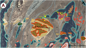
Exploring Neolithic resilience and mobility in the Omani interior at Al-Khashbah KHS-A
-
- Article
-
- You have access
- HTML
- Export citation
