Refine search
Actions for selected content:
95780 results in Archaeology
Chapter 3 - Data and Methodology
-
- Book:
- The Rise of Early Rome
- Published online:
- 17 August 2023
- Print publication:
- 31 August 2023, pp 46-57
-
- Chapter
- Export citation
Appendix D: - Data
- from Data, Mathematical Explanations and Calculations
-
- Book:
- The Rise of Early Rome
- Published online:
- 17 August 2023
- Print publication:
- 31 August 2023, pp 207-208
-
- Chapter
- Export citation
Appendix B: - Modelling from Chapter 7 Step-by-Step
- from Data, Mathematical Explanations and Calculations
-
- Book:
- The Rise of Early Rome
- Published online:
- 17 August 2023
- Print publication:
- 31 August 2023, pp 137-158
-
- Chapter
- Export citation
Chapter 1 - The Ancient City
-
- Book:
- The Rise of Early Rome
- Published online:
- 17 August 2023
- Print publication:
- 31 August 2023, pp 8-28
-
- Chapter
- Export citation
Acknowledgements
-
- Book:
- The Rise of Early Rome
- Published online:
- 17 August 2023
- Print publication:
- 31 August 2023, pp xvii-xviii
-
- Chapter
- Export citation
Chapter 2 - Transportation Infrastructures
-
- Book:
- The Rise of Early Rome
- Published online:
- 17 August 2023
- Print publication:
- 31 August 2023, pp 29-45
-
- Chapter
- Export citation
Notes
-
- Book:
- The Rise of Early Rome
- Published online:
- 17 August 2023
- Print publication:
- 31 August 2023, pp 209-226
-
- Chapter
- Export citation
Index
-
- Book:
- The Rise of Early Rome
- Published online:
- 17 August 2023
- Print publication:
- 31 August 2023, pp 259-268
-
- Chapter
- Export citation
The SISAL webApp: exploring the speleothem climate and environmental archives of the world
-
- Journal:
- Quaternary Research / Volume 118 / March 2024
- Published online by Cambridge University Press:
- 30 August 2023, pp. 211-217
-
- Article
-
- You have access
- Open access
- HTML
- Export citation
From Slavery to Servitude: Transformations and Continuities in Hacienda Labor, Well-Being, and Foodways in Eighteenth- and Nineteenth-Century Nasca
-
- Journal:
- Latin American Antiquity / Volume 35 / Issue 3 / September 2024
- Published online by Cambridge University Press:
- 30 August 2023, pp. 612-628
- Print publication:
- September 2024
-
- Article
-
- You have access
- Open access
- HTML
- Export citation
Vegetation dynamics in Dhofar, Oman, from the Late Holocene to present inferred from rock hyrax middens
-
- Journal:
- Quaternary Research / Volume 116 / November 2023
- Published online by Cambridge University Press:
- 30 August 2023, pp. 12-29
-
- Article
-
- You have access
- Open access
- HTML
- Export citation
More than Shelter from the Storm: Hunter-Gatherer Houses and the Built Environment. Brian N. Andrews and Danielle A. Macdonald, editors. 2022. xi + 283 pp. University Press of Florida, Gainesville. $90.00 (hardcover), ISBN 978-0-8130-6937-1.
-
- Journal:
- American Antiquity / Volume 88 / Issue 4 / October 2023
- Published online by Cambridge University Press:
- 30 August 2023, pp. 594-595
- Print publication:
- October 2023
-
- Article
- Export citation
Human–environment interactions at Ta'ab Nuk Na, a submerged Maya salt works site in Belize
-
- Journal:
- Ancient Mesoamerica / Volume 35 / Issue 2 / Summer 2024
- Published online by Cambridge University Press:
- 29 August 2023, pp. 388-400
-
- Article
-
- You have access
- Open access
- HTML
- Export citation
Coastal and maritime archaeology in Cyrenaica, Libya: history, developments, site identification and challenges
-
- Journal:
- Libyan Studies / Volume 54 / November 2023
- Published online by Cambridge University Press:
- 29 August 2023, pp. 160-178
- Print publication:
- November 2023
-
- Article
-
- You have access
- Open access
- HTML
- Export citation
Forensic Archaeology: Multidisciplinary Perspectives. Kimberlee Sue Moran and Claire L. Gold, editors. 2019. Springer, Cham, Switzerland. xi + 333 pp. $159.99 (hardcover), ISBN 978-3-030-03289-0. $119.99 (e-book), ISBN 978-3-030-03291-3.
-
- Journal:
- American Antiquity / Volume 88 / Issue 4 / October 2023
- Published online by Cambridge University Press:
- 29 August 2023, pp. 620-621
- Print publication:
- October 2023
-
- Article
- Export citation
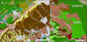
Crossing Crawford's conceptual divide: monumental linear earthworks in later prehistoric and early medieval Britain
-
- Article
-
- You have access
- Open access
- HTML
- Export citation
Gathering Ground: Unearthing 3000 Years of Prehistory at Faughan Hill, Eastern Ireland
-
- Journal:
- Proceedings of the Prehistoric Society / Volume 89 / December 2023
- Published online by Cambridge University Press:
- 29 August 2023, pp. 83-126
- Print publication:
- December 2023
-
- Article
-
- You have access
- Open access
- HTML
- Export citation
New and multidisciplinary methods investigating Roman water management: aqueducts and castella in Rome and Pompeii - G. Wiplinger, ed. 2020. De aquaeductu urbis Romae. Sextus Iulius Frontinus and the Water of Rome: Proceedings of the International Frontinus Congress Rome, November 10–18, 2018. Babesch Supplementa 40. Leuven: Peeters. Pp. xxxiii, 403. ISBN 978-90-429-4311-7.
-
- Journal:
- Journal of Roman Archaeology / Volume 36 / Issue 2 / December 2023
- Published online by Cambridge University Press:
- 29 August 2023, pp. 604-612
- Print publication:
- December 2023
-
- Article
- Export citation
LASER ABLATION SYSTEM WITH A DIODE LASER FOR AMS 14C MEASUREMENT OF ORGANIC MATERIALS
-
- Journal:
- Radiocarbon / Volume 66 / Issue 5 / October 2024
- Published online by Cambridge University Press:
- 29 August 2023, pp. 1238-1247
- Print publication:
- October 2024
-
- Article
-
- You have access
- Open access
- HTML
- Export citation
