Refine search
Actions for selected content:
95781 results in Archaeology
Neighbours of the Apsaros Fort. Local Tribes on the Black Sea Coast during the Principate
-
- Journal:
- Cambridge Archaeological Journal / Volume 35 / Issue 1 / February 2025
- Published online by Cambridge University Press:
- 13 November 2024, pp. 169-187
-
- Article
-
- You have access
- Open access
- HTML
- Export citation
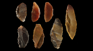
Prehistoric communities in the Bayuda Desert, Sudan
-
- Article
-
- You have access
- Open access
- HTML
- Export citation
The Use-Life of Ancestors: Neolithic Cranial Retention, Caching and Disposal at Masseria Candelaro, Apulia, Italy
-
- Journal:
- European Journal of Archaeology / Volume 28 / Issue 1 / February 2025
- Published online by Cambridge University Press:
- 13 November 2024, pp. 3-23
-
- Article
-
- You have access
- Open access
- HTML
- Export citation
Food and Labour under Imperial Rule: Unravelling the Food Landscape of Transplanted Workers (mitmaqkuna) in the Inka Empire
-
- Journal:
- Cambridge Archaeological Journal / Volume 35 / Issue 1 / February 2025
- Published online by Cambridge University Press:
- 13 November 2024, pp. 207-226
-
- Article
-
- You have access
- Open access
- HTML
- Export citation
Textiles and Staple Finance in the Near East and the Southern Levant
-
- Journal:
- Cambridge Archaeological Journal / Volume 34 / Issue 4 / November 2024
- Published online by Cambridge University Press:
- 13 November 2024, pp. 793-812
-
- Article
- Export citation
Aboriginal Rock Art and the Telling of History
-
- Published online:
- 12 November 2024
- Print publication:
- 05 December 2024
Locating al-Qadisiyyah: mapping Iraq's most famous early Islamic conquest site
- Part of
-
- Article
-
- You have access
- Open access
- HTML
- Export citation
The archaeological record of the Qaraçay River Basin along the northern piedmont of the Lesser Caucasus
-
- Article
-
- You have access
- Open access
- HTML
- Export citation
Objects, affordances, and material histories in Roman Palestine: a case study on Northern Collar-Neck Lamps and their uses in early Jewish Sources
-
- Journal:
- Journal of Roman Archaeology / Volume 37 / Issue 2 / December 2024
- Published online by Cambridge University Press:
- 11 November 2024, pp. 508-534
- Print publication:
- December 2024
-
- Article
-
- You have access
- Open access
- HTML
- Export citation
Recycling the Roman Villa
- Material Salvage and the Medieval Circular Economy
-
- Published online:
- 08 November 2024
- Print publication:
- 31 October 2024
Making plundered spaces sacred again: fragmentation, reorganisation and respect in reused Theban tombs
-
- Article
-
- You have access
- Open access
- HTML
- Export citation
Exploring Climate Change Adaptations for Cultural Heritage: The ADAPT Framework
-
- Journal:
- Advances in Archaeological Practice / Volume 12 / Issue 3 / August 2024
- Published online by Cambridge University Press:
- 08 November 2024, pp. 313-321
-
- Article
-
- You have access
- Open access
- HTML
- Export citation
Airborne lidar at Guiengola, Oaxaca: Mapping a Late Postclassic Zapotec city
-
- Journal:
- Ancient Mesoamerica / Volume 35 / Issue 3 / Fall 2024
- Published online by Cambridge University Press:
- 08 November 2024, pp. 899-916
-
- Article
-
- You have access
- Open access
- HTML
- Export citation
Ethical entanglements: human remains, museums and ethics in a European perspective
-
- Article
-
- You have access
- Open access
- HTML
- Export citation
Testing of Shoreline Erosion Monitoring Methodologies for Heritage at Risk Sites: Pockoy Island, South Carolina, USA
-
- Journal:
- Advances in Archaeological Practice / Volume 12 / Issue 3 / August 2024
- Published online by Cambridge University Press:
- 08 November 2024, pp. 276-288
-
- Article
- Export citation
The Legacy of Ann Cyphers for Olmec Archaeology: Ann Cyphers (1950–2023)
-
- Journal:
- Ancient Mesoamerica / Volume 35 / Issue 3 / Fall 2024
- Published online by Cambridge University Press:
- 08 November 2024, pp. 997-1002
-
- Article
-
- You have access
- HTML
- Export citation
New data about the use of coinage in Late Antique Tridentum (Trento, Italy)
-
- Journal:
- Journal of Roman Archaeology / Volume 37 / Issue 2 / December 2024
- Published online by Cambridge University Press:
- 08 November 2024, pp. 557-586
- Print publication:
- December 2024
-
- Article
-
- You have access
- Open access
- HTML
- Export citation
Landscape Histories and the Search for Early Settlements along Louisiana's Bayous
-
- Journal:
- Advances in Archaeological Practice / Volume 12 / Issue 3 / August 2024
- Published online by Cambridge University Press:
- 08 November 2024, pp. 259-275
-
- Article
- Export citation
Figures
-
- Book:
- Women and the Army in the Roman Empire
- Published online:
- 24 October 2024
- Print publication:
- 07 November 2024, pp ix-xi
-
- Chapter
- Export citation
Appendix 2 - Appendices
- from 7 - (In)Visible Women and Children
-
- Book:
- Women and the Army in the Roman Empire
- Published online:
- 24 October 2024
- Print publication:
- 07 November 2024, pp 216-218
-
- Chapter
- Export citation
