Refine search
Actions for selected content:
95780 results in Archaeology
ANT volume 103 Cover and Back matter
-
- Journal:
- The Antiquaries Journal / Volume 103 / October 2023
- Published online by Cambridge University Press:
- 07 December 2023, pp. b1-b2
- Print publication:
- October 2023
-
- Article
-
- You have access
- Export citation
Ralegh Radford Rome Awards: Protesting celebrity: mass culture and the 1968 Venice Biennale protests
-
- Journal:
- Papers of the British School at Rome / Volume 91 / October 2023
- Published online by Cambridge University Press:
- 16 November 2023, pp. 360-361
- Print publication:
- October 2023
-
- Article
- Export citation
DATING THE END OF THE EGYPTIAN OLD KINGDOM: NEW CONTEXTUALIZED DATES FROM THE REIGN OF KING PEPY II
-
- Journal:
- Radiocarbon / Volume 65 / Issue 5 / October 2023
- Published online by Cambridge University Press:
- 07 November 2023, pp. 1080-1097
- Print publication:
- October 2023
-
- Article
-
- You have access
- Open access
- HTML
- Export citation
Macquarie Gale Rome Scholarship: Beyond the rock and the hard place: empire, landscape and connectivity in the Strait of Messina (300 BC–AD 300)
-
- Journal:
- Papers of the British School at Rome / Volume 91 / October 2023
- Published online by Cambridge University Press:
- 16 November 2023, pp. 367-368
- Print publication:
- October 2023
-
- Article
- Export citation
AUSTRALIAN MARINE RADIOCARBON RESERVOIR EFFECTS: ΔR ATLAS AND ΔR CALCULATOR FOR AUSTRALIAN MAINLAND COASTS AND NEAR-SHORE ISLANDS
-
- Journal:
- Radiocarbon / Volume 65 / Issue 5 / October 2023
- Published online by Cambridge University Press:
- 31 October 2023, pp. 1139-1159
- Print publication:
- October 2023
-
- Article
-
- You have access
- Open access
- HTML
- Export citation
INTERAMNA LIRENAS AND ITS TERRITORY (COMUNE DI PIGNATARO INTERAMNA, PROVINCIA DI FROSINONE, REGIONE LAZIO)
-
- Journal:
- Papers of the British School at Rome / Volume 91 / October 2023
- Published online by Cambridge University Press:
- 16 November 2023, pp. 335-338
- Print publication:
- October 2023
-
- Article
- Export citation
A lady of leadership: 3D-scanning of runestones in search of Queen Thyra and the Jelling Dynasty
-
- Article
-
- You have access
- Open access
- HTML
- Export citation
THE POTENTIAL OF BIOGENIC FRACTION ANALYSIS BY RADIOCARBON IN FOOD, DRUG, AND COSMETIC PRODUCTS
-
- Journal:
- Radiocarbon / Volume 65 / Issue 5 / October 2023
- Published online by Cambridge University Press:
- 07 November 2023, pp. 1176-1192
- Print publication:
- October 2023
-
- Article
-
- You have access
- Open access
- HTML
- Export citation
Ralegh Radford Rome Awards: Wine culture in the Iranian Plateau: undoing the classical narrative of Dionysus in the East
-
- Journal:
- Papers of the British School at Rome / Volume 91 / October 2023
- Published online by Cambridge University Press:
- 16 November 2023, pp. 361-362
- Print publication:
- October 2023
-
- Article
- Export citation
RDC volume 65 issue 5 Cover and Front matter
-
- Journal:
- Radiocarbon / Volume 65 / Issue 5 / October 2023
- Published online by Cambridge University Press:
- 07 December 2023, pp. f1-f3
- Print publication:
- October 2023
-
- Article
-
- You have access
- Export citation
Paul Mellon Centre Fellowship: Robert Turnball Macpherson and his photographic vedute of Rome in comparison to works of other photographers in his time
-
- Journal:
- Papers of the British School at Rome / Volume 91 / October 2023
- Published online by Cambridge University Press:
- 16 November 2023, pp. 366-367
- Print publication:
- October 2023
-
- Article
- Export citation
British Women and Cultural Practices of Empire. Edited by Rosie Dias and Kate Smith. 225mm. Pp xiii + 273, 11 col pls, 27 figs. Bloomsbury Visual Arts, Bloomsbury, London, 2019. isbn 9781501332159. £102 (hbk).
-
- Journal:
- The Antiquaries Journal / Volume 103 / October 2023
- Published online by Cambridge University Press:
- 31 October 2023, pp. 464-465
- Print publication:
- October 2023
-
- Article
- Export citation
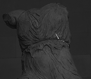
The goddess’ new clothes: the carving and polychromy of the Parthenon Sculptures
- Part of
-
- Article
-
- You have access
- Open access
- HTML
- Export citation
Balsdon Fellowships: Visual cultures of landscape in the Fascist imaginary
-
- Journal:
- Papers of the British School at Rome / Volume 91 / October 2023
- Published online by Cambridge University Press:
- 16 November 2023, pp. 348-349
- Print publication:
- October 2023
-
- Article
- Export citation
THE NEED FOR A NEW APPROACH TO THE RADIOCARBON DATING OF HISTORIC MORTARS
-
- Journal:
- Radiocarbon / Volume 65 / Issue 5 / October 2023
- Published online by Cambridge University Press:
- 03 November 2023, pp. 1017-1021
- Print publication:
- October 2023
-
- Article
- Export citation
Kanyimangin: the Early to Middle Pleistocene Transition in the south-west of the Turkana Basin
- Part of
-
- Article
-
- You have access
- Open access
- HTML
- Export citation
TESTING THE USE OF XAD RESIN TO REMOVE SYNTHETIC CONTAMINATION FROM ARCHAEOLOGICAL BONE PRIOR TO RADIOCARBON DATING
-
- Journal:
- Radiocarbon / Volume 65 / Issue 5 / October 2023
- Published online by Cambridge University Press:
- 13 November 2023, pp. 1160-1175
- Print publication:
- October 2023
-
- Article
-
- You have access
- Open access
- HTML
- Export citation
BONE POINTS IN TIME: DATING HUNTER-GATHERER BONE POINTS IN THE TERRITORY OF LITHUANIA
-
- Journal:
- Radiocarbon / Volume 65 / Issue 5 / October 2023
- Published online by Cambridge University Press:
- 31 October 2023, pp. 1118-1138
- Print publication:
- October 2023
-
- Article
-
- You have access
- Open access
- HTML
- Export citation
THE 2022 EXCAVATIONS AT THE SAMNITE AND ROMAN SETTLEMENT AT SANTA MARIA DELLA STRADA, MATRICE (PROVINCIA DI CAMPOBASSO, REGIONE MOLISE)
-
- Journal:
- Papers of the British School at Rome / Volume 91 / October 2023
- Published online by Cambridge University Press:
- 16 November 2023, pp. 342-345
- Print publication:
- October 2023
-
- Article
- Export citation
Rome Fellowships: TULAR: human mobility and social–cultural shifts in frontier areas of pre-Roman Italy
-
- Journal:
- Papers of the British School at Rome / Volume 91 / October 2023
- Published online by Cambridge University Press:
- 16 November 2023, pp. 353-354
- Print publication:
- October 2023
-
- Article
- Export citation
